White Rocks Area (GSENM)
In a small corner and seldom visited area of the Grand Staircase-Escalante National Monument (GSENM) in Utah lays a labyrinth of wild and crazy rock formations simply known as White Rocks. This place is a big treasure chest of unusual geologic formations, from over a hundred hoodoos or toadstools, to rock layers that seem to be dripping away. And, can you guess what color the rocks are?
")
")
Trip Specs
Length
Attractions
- Unusual rock formations
- Numerous hoodoos/toadstools
- Very unique landscapes
Difficulty
- Easy to drive to trailhead
- Challenging to navigate
- Easy to get lost
- Very remote area – cell phones may not work
The following article includes additional information to what is explained in the video above. There’s so much to see, study and ponder about in the White Rocks area. Below, you’ll find more information about different features found in White Rocks, along with our best guesses to what’s going on with what you’re seeing and how it was created. We say, best guesses, because there is very little information available about this place.
Introduction
As mentioned in the video, White Rocks offers so many wild and bizarre landscapes. It’s as if world-renowned animator Dr. Suess met 1960s-era psychedelic rock star Jerry Garcia, on the classic TV show The Twilight Zone, which was made famous by showcasing bizarre and mysterious things. In reality though, the White Rocks area boasts some of the most unusual rock formations that we have encountered in the Southwest. In our opinion, it rates similarly to the rock formations and fantastic scenery of the Coyote Buttes area, including The Wave.
Details covered in this article:
- Getting There & The Layout of White Rocks (its three distinctive regions)
- Landscapes you’ll see in each of the three regions
- The geological concept of “cross-bedding” and how it appears differently here
- A theory as to the creation of a highly mineralized (aka colorful) rock outcrop
- The geologic layers of Entrada Formation “members” seen throughout White Rocks
- Tips on photographing White Rocks
Getting There
White Rocks is located between Page, Arizona and Kanab, Utah. It’s located in the very south-central portion of the Grand Staircase-Escalante National Monument. It’s also at the base of the very southern end of the enormous Kaiparowits Plateau.
The turnoff from US Hwy 89 to White Rocks is located near the small hamlet of Church Wells, which is 20 miles (32 km) west of Glen Canyon Dam (on Hwy 89) and 51 miles (81.5 km) from Kanab (also on Hwy 89). BLM Road 435, which is dirt, is found on the east end of Church Wells. This road ends in 3.5 miles (5.6 km) from Hwy 89 at two trailheads, both leading into White Rocks.
WARNING:
The Layout of White Rocks
White Rocks is a series of canyons, valleys and ridges. It is broken down into three distinctive areas. They are:
- The canyon or small valley of Zebra Hoodoo
- White Valley
- Sidestep Canyon
Map
If you choose to explore White Rocks on your own, we highly recommend utilizing a mapping app on your phone. In our opinion, a subscription to Gaia GPS is the best solution. Since phone reception is sketchy at White Rocks, you cannot expect to get an internet connection that will provide you with map data to see where you’re located. Gaia GPS has the option to download a selected portion of their map (and other map layers) to your phone, so it will work off-line from the internet while you’re deep in one of the canyons.
One very helpful feature of Gaia GPS is the ability to plan your trip on your computer using Gaia GPS or Google Earth. You can mark the places (i.e., waypoints) that look interesting, and you want to visit, then save them to your Gaia GPS account. Then, when you open Gaia GPS on your phone, those waypoints will appear, which will make navigating to those places and making your hike much easier and giving you more confidence.
Below is a map plotting places discussed in the article. Click on this ad to purchase Gaia GPS with our discount:

Learn more about our maps.
Turn left (north) here.
Support Us
Help us fill up our tank with gas for our next trip by donating $5 and we’ll bring you back more quality virtual tours of our trips!
Your credit card payment is safe and easy using PayPal. Click the [Donate] button to get started:
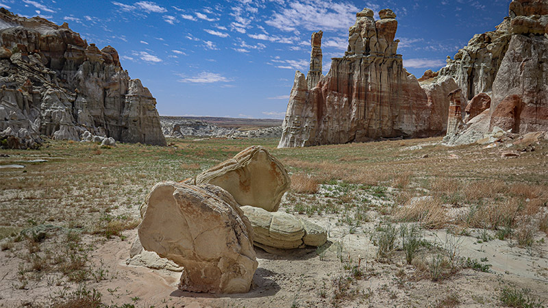
What You’ll See
White Rocks offers scenery and rock formations not commonly found anywhere else in North America. You can probably guess what color the scenery is – white. Along with the dominant, white-colored landscape are smatterings of different colors, some purplish bands in the middle, thin and wide bads of reddish-purple, thin streaks of green, along with layers of yellows, pinks, reds and browns at the tops of the ridges.
White Rocks is bordered to the east by the large drainage of Wahweap Wash. Located on this east edge is the Wahweap Hoodoos. These are two clusters of very large toadstools that are found along Wahweap Wash but are not near the White Rocks area we cover in this article. Visting the Wahweap Hoodoos is not done from White Rocks but from a trailhead near the town of Big Water.
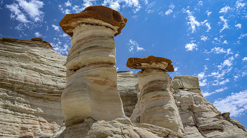
Are they Hoodoos are Toadstools?
In the video and in this article, you’ll see that we use the term hoodoo and toadstool interchangeably. There are actually differences between a hoodoo and a toadstool.
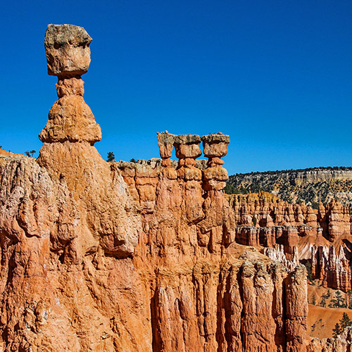
The term “hoodoo” is most commonly used in Bryce Canyon to describe the thousands of white and orange colored single pinnacles or rock formations sticking up vertically. They range in height from five to maybe a hundred feet. Hoodoos are typically rounded on top and consist of one geologic rock formation. In Bryce Canyon, that formation is the Claron Formation. Hoodoos can also be found in Goblin Valley State Park, also in Utah, and Chiricahua National Monument in Arizona.
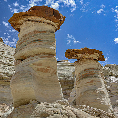
The term “toadstool” is used to describe a geologic formation that is like a hoodoo but has a hardened cap rock at the top that is usually wider than the hoodoo portion (neck or base) of the toadstool. The cap rock looks like a hoodoo with a hat on top. It’s likened to a “sitting stool for a toad”, which is how it got its name. This cap rock is typically a color (often a dark color) that is much different than the hoodoo portion (often a lighter color). Toadstools are typically formed by a less-erosion-proof earthen layer below (the base) that is protected by a small, hardened rock layer above, known as a “cap rock”.
Of all the travels we’ve made throughout the Southwest, in our opinion, White Rocks has the highest concentration of toadstools. There’s easily over 100 toadstools scattered around the White Rocks area.
The Two Trailheads
Near the end of BLM Road 435, you’ll find a large cattle corral and a reservoir to store water for the cattle. One time when we were there, there was a group of classic cowboys that were busy managing their cattle.
Just past the corral on the right is the first trailhead. This trailhead is used for accessing the bottom of White Valley and Sidestep Canyon.
Past the first trailhead, the second trailhead is reached in a very short distance, which is where the road ends. This trailhead is used for accessing Zebra Hoodoo, the northern top of White Valley and Sidestep Canyon. On one occasion, we parked at this trailhead to start a big loop visiting all three areas in White Rocks and came out at the first trailhead, then walked back to our vehicle parked at the second trailhead.
When hiking out of either trailhead, use the tall rock outcrop named Chimney Rock as a visual point of reference to help you determine where you’re located in White Rocks. The hike we did once starting at the second trailhead and ending at the first, consisted of making a large counter-clockwise path around Chimney Rock, looking for it often to give us a point of reference.
Valley Containing Zebra Hoodoo
This small valley or wide canyon is a side drainage to the main drainage that the second trailhead sits in. After starting at the trailhead, it is easy to find an established trail (double track) that leads up the drainage. After walking up the main drainage about half a mile, bear right into the side drainage. The side drainage ends at Zebra Hoodoo at the very end with high cliffs on all three sides.
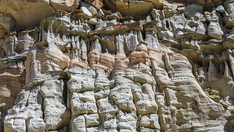
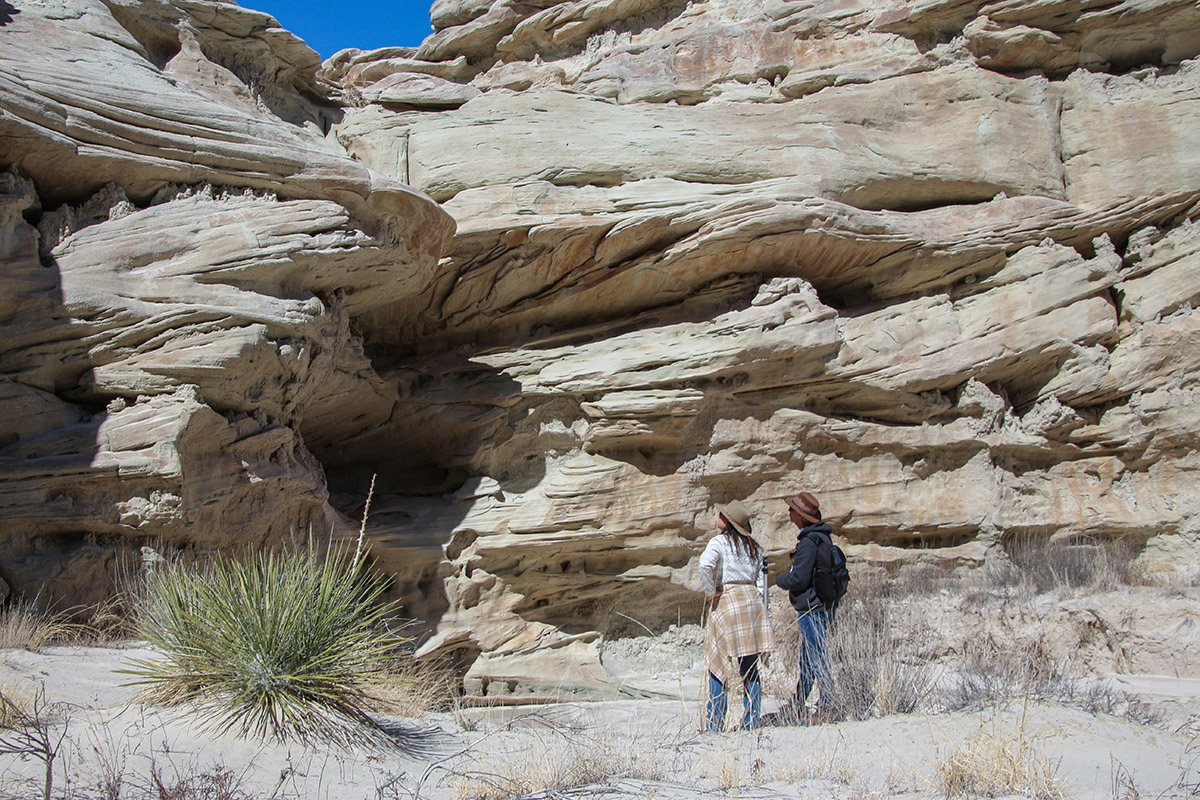
About the last quarter mile of this drainage, the cliffs on both sides are full of very delicate, whimsical, and unusually shaped rock formations. Make sure to walk near these cliffs to study and look over these formations.
The lone hoodoo in this drainage is Zebra Hoodoo and is located near the end of the drainage. Unlike many other hoodoos in the White Rocks area that are white with a dark brown top, Zebra has many horizontal reddish-brown stripes, hence its name. There are a few other hoodoos in the Sidestep Canyon area that are similar, but none stack up to the perfect hoodoo that is Zebra Hoodoo.
About a half mile south of Zebra Hoodoo, is a side canyon heading east with a cluster of about five hoodoos, along with yet more unique rock formations and layers. Near the end of this drainage, a few trails can be found that climb out of the drainage and head east towards the top end of White Valley’s left fork. Just beware that these trails are steep, sandy, and are difficult to climb. Once at the top, there is a well-defined trail that can be found heading east.
White Valley
The first trailhead sits at the mouth of the main drainage exiting White Valley. This would make an obvious starting point to exploring the various features and branches of White Valley. However, there are other trails to see and access White Valley.
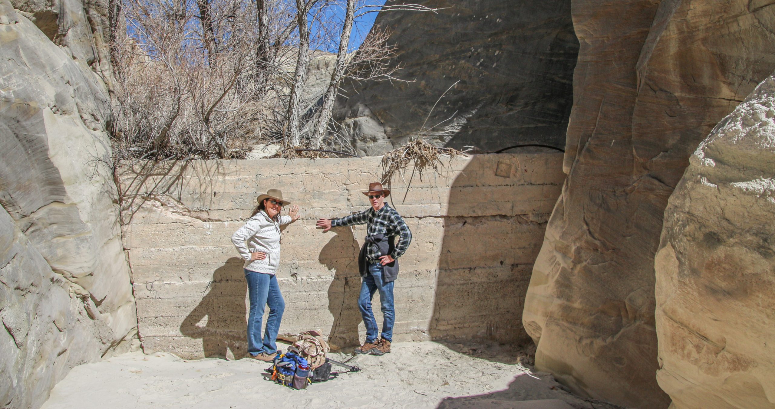
Hiking up the White Valley drainage is an easy walk for the first mile. That’s about when the 8-foot-high rancher’s dam is encountered. Rumor has it that occasionally there is a ladder here to climb over the dam. If there isn’t, it will need to be scaled which is easier with three or more people to help each other up. It can be bypassed by climbing the steep sloping sandstone on the east/south side of the canyon. Naturally, going down the dam is much easier on the return trip.
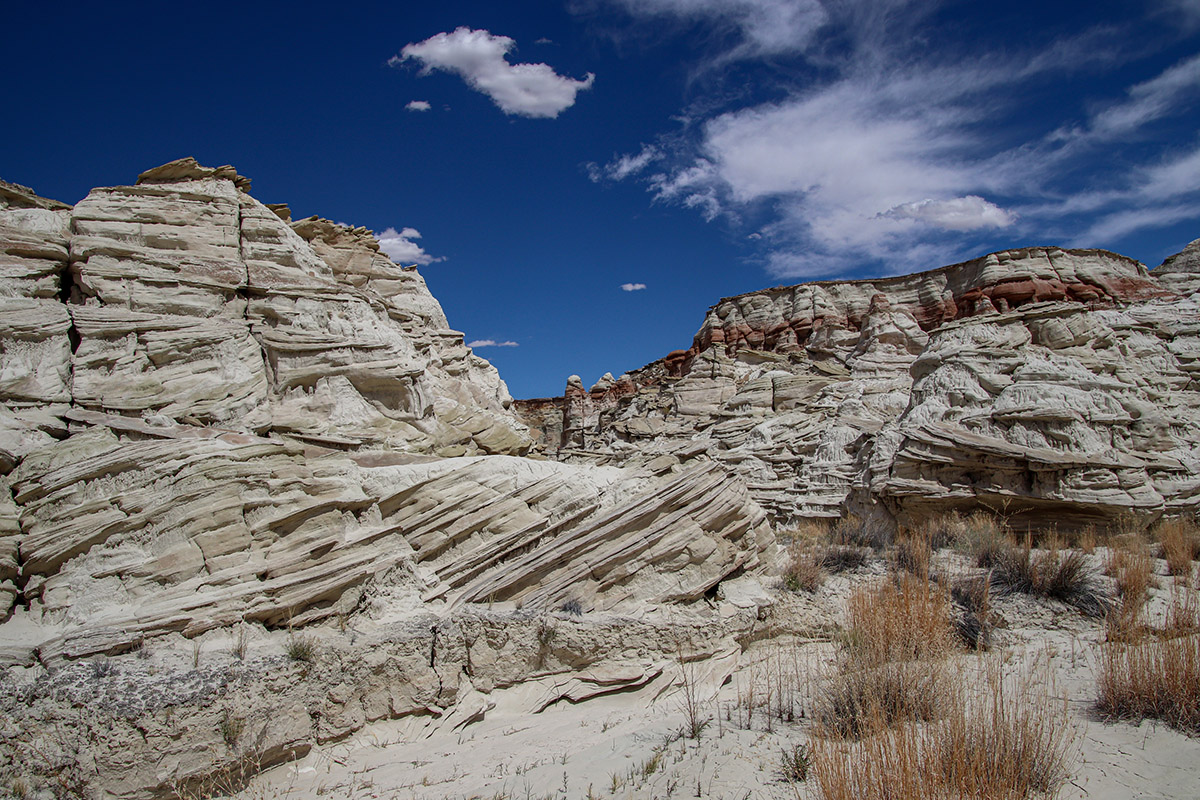
About a third of a mile past the dam, the drainage of White Valley splits into two. This is the center of White Valley. It’s fairly wide compared to other parts of the drainages, which is probably why most maps refer to this area as a “valley”. All around this center is a vast sea of white Entrada Sandstone in various stages of erosion. Some of this terrain appears as actual hardened sandstone, whereas other terrain is comprised of softer mudstones that appear to be melting or oozing down from the cliffs above the drainage.
Above this point, we’ll refer to the two drainages as the right and left fork. Heading up the left fork, the drainage narrows quickly and turns into a canyon. Soon, it turns into a slot canyon, with its entrance guarded by a muddy pool. We didn’t pass this point. Looking into the slot canyon, we saw more pools of muddy water. We noticed this when we visited in March, but hopefully in late fall after any monsoon activity, the slot canyon would probably be dry.
Heading up the right fork passes through wider sections of White Valley, then the drainage narrows quickly into another slot canyon. There seems to be nowhere along here for water to pool, making it easier to walk through these narrows. In this slot canyon, we noticed many “candle wax drippings” on the vertical walls of the canyon. This slot canyon was partially blocked by several rock falls halfway through where one would need to scramble over piles of rubble. Although we didn’t explore this slot canyon all the way through, this drainage presumably ends at the top of the canyon and just on the other side of the top of Sidestep Canyon.
Sidestep Canyon
This area includes even more bizarre rock formations and scenery. Like White Valley, it consists of a canyon with two branches, with the branch almost touching the right fork of White Valley that includes the most interesting and bizarre landscapes, including an unusual slot canyon.
There is a 4WD road that separates the top of Sidestep Canyon and the right fork of White Valley. This is a branch off the controversial BLM Road 431. It’s controversial because it has been “illegally” closed to the public. Its closure is marked by a gate that is supposedly either open or closed with a sign indicating “administrative road” and that entry is forbidden. However, we’ve heard of plenty of people opening the gate and resuming their drive to both the Waheap Hoodoos and the tops of Sidestep Canyon and White Valley. Road 431 begins at Cottonwood Canyon Road (BLM Road 400) and the branch road starts off 431, 8 miles in. Heading south on the branch road reaches the top of Sidestep in 1.2 miles. We have never taken this road, so we don’t know its condition, other than it is a rough road requiring high clearance 4WD. Bottom line, take this road knowing that there is a risk of being fined by BLM law enforcement.
During two different hikes, we reached Sidestep Canyon two different ways. One was coming up from the second trailhead via the Zebra Hoodoo drainage explained earlier, and the other was from the first trailhead using a hidden, but well used trail, that skirted the south rim of White Valley.
From the top of the fork of Sidestep Canyon closest to White Valley (closest to the branch road mentioned above), one can walk along its edge to admire the landscapes below. A little less than a hundred feet below the canyon’s rim is a broad shelf that can be seen on both sides of the canyon. Exploring this shelf reveals a moonscape of rock formations and toadstools. Looking down to where the deeper slot canyon sits are hundreds of mushroom-shaped rocks protruding out of the canyon.
Getting from that shelf, then down into the slot canyon itself is difficult. We bypassed this whole area by descending a less steep slope in the main part of the canyon. From there, we walked up both forks of Sidestep Canyon, with each fork revealing its own set of unique landscapes and rock formations.
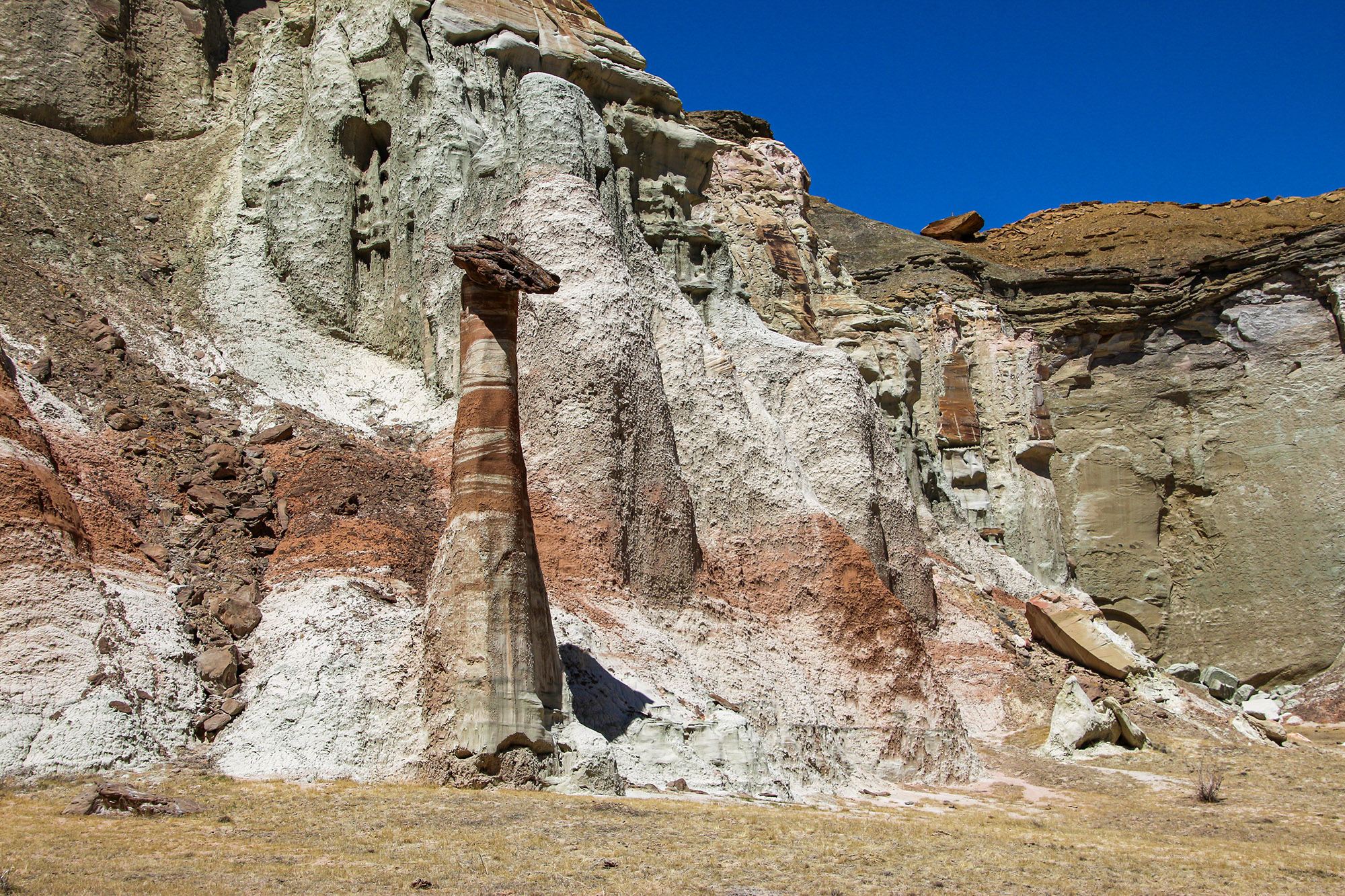
Below the confluence of the two forks, a quarter-mile-long side canyon heads north from the main drainage that is interesting to explore. The left fork of this side canyon ends where the largest toadstool we’ve ever seen is encountered. This formation is just over 100 feet tall! To me, it was very intimidating.
Pictures:

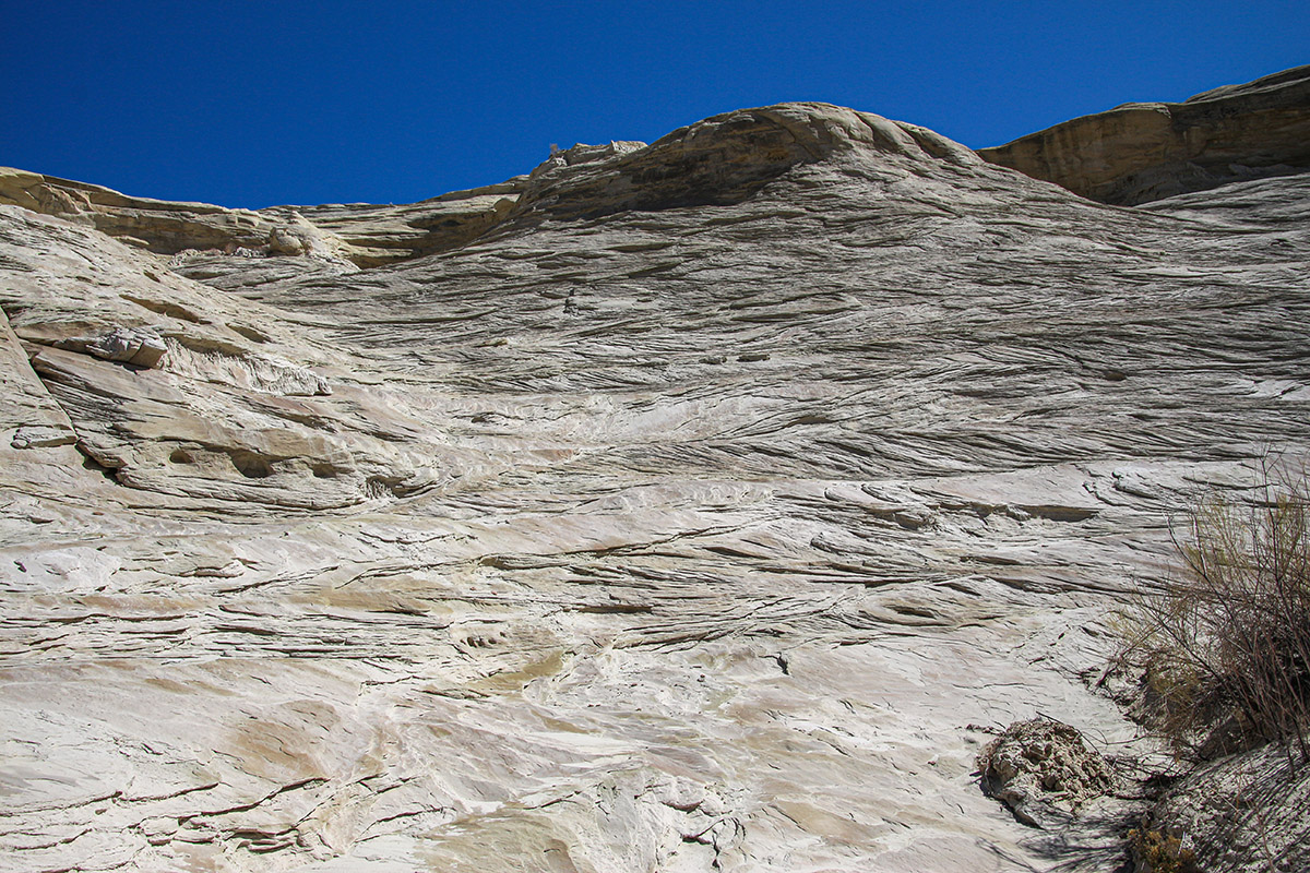
Cross-bedding
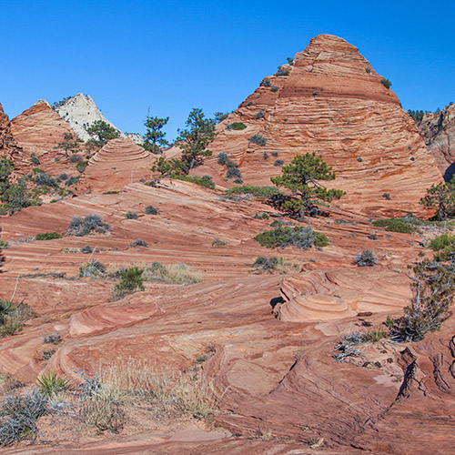
As learned in the video, most of the White Rocks area sits in the Entrada Sandstone formation. Like the Navajo Sandstone formation, famously exposed in Zion National Park, the Entrada Sandstone sports various forms of what’s referred to as cross-bedding, also known as cross-stratification.
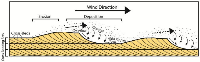
Remember that both the Navajo and the Entrada are remnants of enormous ancient Jurassic-aged sand dunes. As can be witnessed at modern-day sand dunes, such as nearby Coral Pink Sand Dunes west of Kanab, the wind shifts the sands up and over shallow slopes of accumulated sand. This creates many mounds on the surface of the sand dunes and is how sand dunes are created. When the wind shifts direction, those slopes are formed in another direction and are formed on top of the previous slope or mound of sand. Below is a diagram of how these mounds are created:
Here’s an example of classic cross-bedding that is common in Zion or the Escalante Canyons section of GSENM:
As more sand piles up and gets higher, the various mounds below it becomes buried. In both the Navajo and Entrada, these mounds piled up, then were eroded away by wind and water many times, for a very long period of time. Finally, the environment changed, and other types of rock were deposited on top of these buried sand dunes and were solidified or petrified, eventually creating sandstone from the previous loose sand.
In current times (the last several thousand years), as water erosion dug deeply into the sandstone layers, they revealed these now petrified sand mounds with the lines indicating the ancient slopes of the sand dunes. Cross-bedding patterns can be found in the Navajo Sandstone throughout the Colorado Plateau.
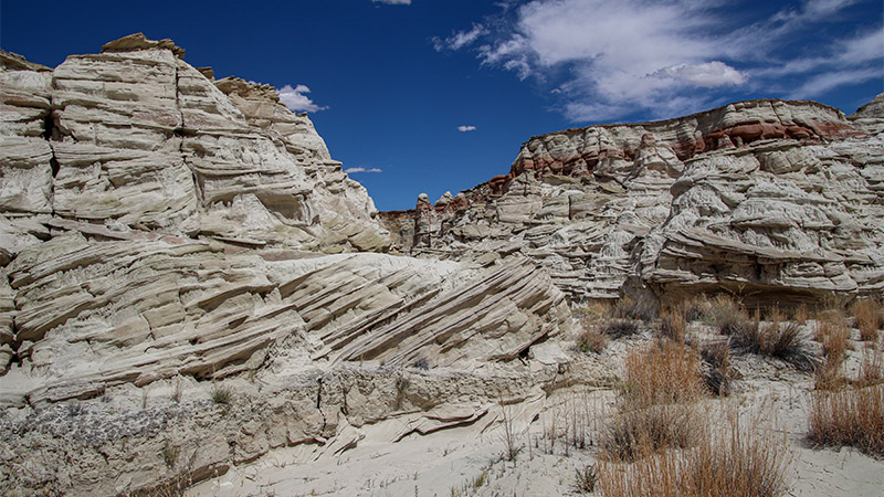
However, in the White Rocks area, when the Entrada eroded, it revealed cross-bedding that looks very different in the three areas, probably because of different material that was deposited during the age when the sand dunes were forming. In the Navajo, it was mostly 100% sand. In the Entrada, the majority of what was being deposited in the locality around White Rocks was sand, maybe 70%, but there were other types of rock material included.
Walking up the drainage from the first trailhead and towards White Valley, the white sandstone on the right side of the canyon has cross-bedding that appears very similar to what’s found in Zion. Further into White Valley, the cross-bedding changes. Often, it consists of flat layers, but also has angled layers that dip in different directions, similar to the shape of those sand mounds. However, what’s different is that there are hard packed layers interlaced with softer layers. These hard packed layers protrude out because they eroded more slowly than the software layers. Over in Sidestep Canyon, this effect is increased, where those hard packed layers are more like many fins sticking out of the sides of the canyon.
Examining all these geologic effects is why it takes a long time to walk through the White Rocks area. One really needs to take the time to examine all the canyon walls and surfaces to really appreciate the uniqueness of geologic forces that occurred at White Rocks.
Examples of the different styles of crossbedding at White Rocks:
The Highly Mineralized Rock Outcrop
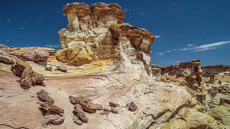
When watching the video, you may recall seeing a very colorful rock outcrop, consisting of brilliant orange and purplish colors, at the canyon rim near the top of White Valley’s right fork. At first examination, this appears to be a very highly mineralized outcropping that oxidized and created the colors seen in the video. But is that how these colors were really created?
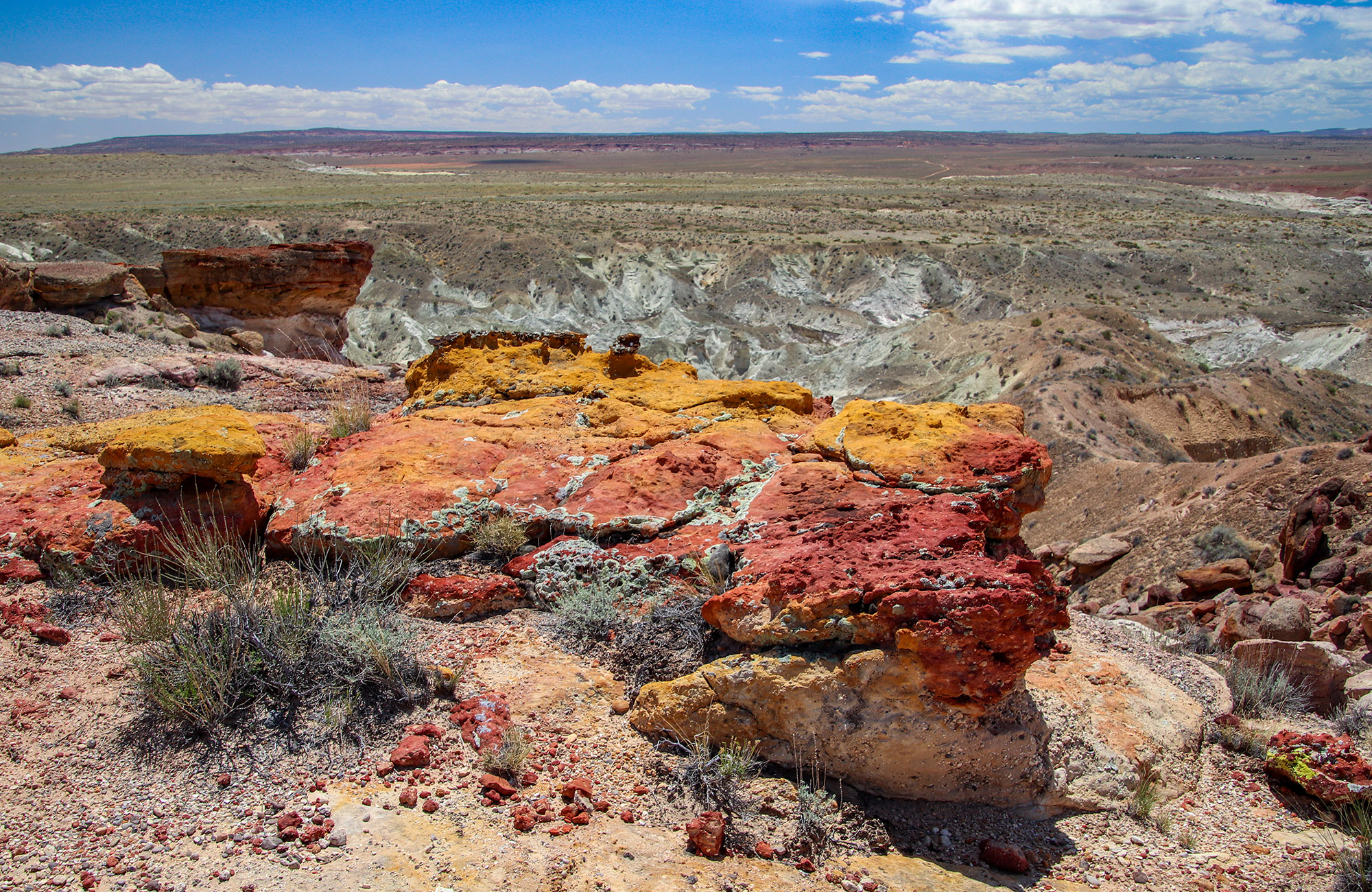
After discussing this outcrop with other people, studying pictures of other geologic features where odd colors like this formed, and knowing that there was no other feature like this found anywhere in White Rocks, it could be a something real special. It may be the remains of a geyser or fumarole (steam vent).
When geysers erupt, not only do they bring up material from deep below, way below the Entrada Sandstone formation, they spray the surrounding surface with hot liquid material that stains the existing rock. This eruption may have occurred several times until the volatile material was all erupted and spent, creating different rock staining events. Mild staining can be observed all other unrelated rock near the outcrop.
Without closer examination of this outcrop and without an experienced geologist, we can only provide rough guesses as to how this was created.
The Uniform Horizontal Layers
White Rocks is on the Colorado Plateau. If you’re familiar with what that is, it’s a large area that covers the eastern half of Utah, much of northern Arizona, portions of western Colorado and the northwest corner of New Mexico. It’s where most of the spectacular scenic places of interest exist in the Southwest.
This region defined as the Colorado Plateau consists mainly of organized horizontal (flat) layers of rock strata. Regions surrounding the Colorado Plateau are not organized and flat. Instead, they’re upheaved, mixed up and very random. They got that way through various tectonic forces.
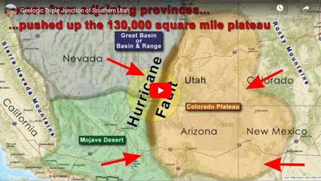
The border between the organized Colorado Plateau geologic province or ecosystem and neighboring provinces with jumbled up rock layers is very evident around St. George Utah. See our article on the Triple Junction of Southwest Utah:
Support Us
Help us fill up our tank with gas for our next trip by donating $5 and we’ll bring you back more quality virtual tours of our trips!
Your credit card payment is safe and easy using PayPal. Click the [Donate] button to get started:
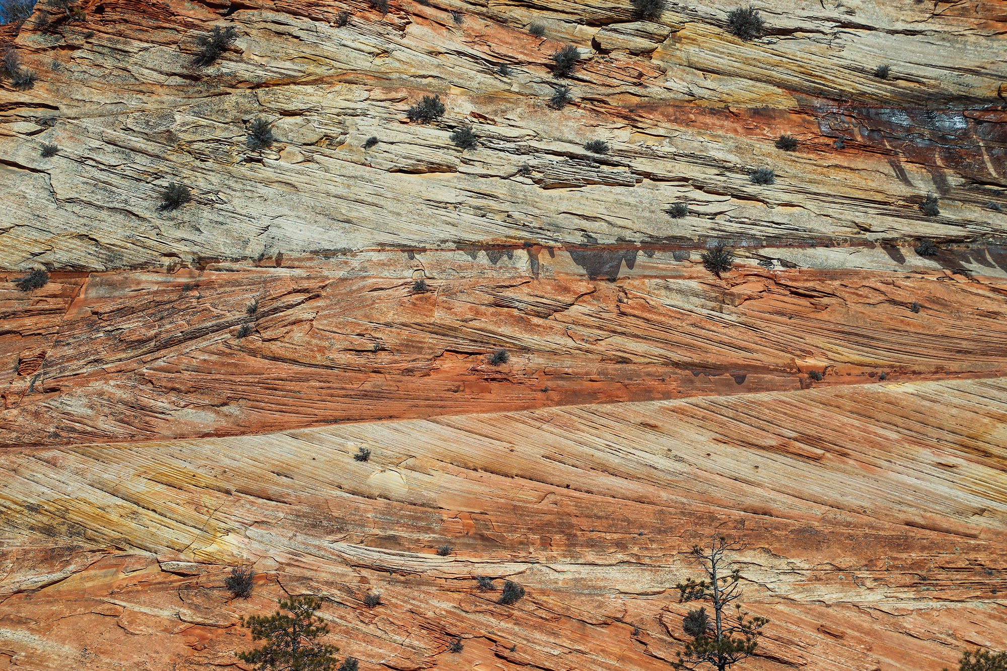
In White Rocks, specifically above the eastern rim of the left fork of White Valley, one can view and marvel at a miniature demonstration of what the Colorado Plateau is all about. Looking east at one point, a view, shown in the picture below, reveals various layers of material within the Entrada Sandstone and the overlaying Naturita Formation, formally classified as the Dakota Formation, that are all relatively flat (parallel to the Earth’s surface).
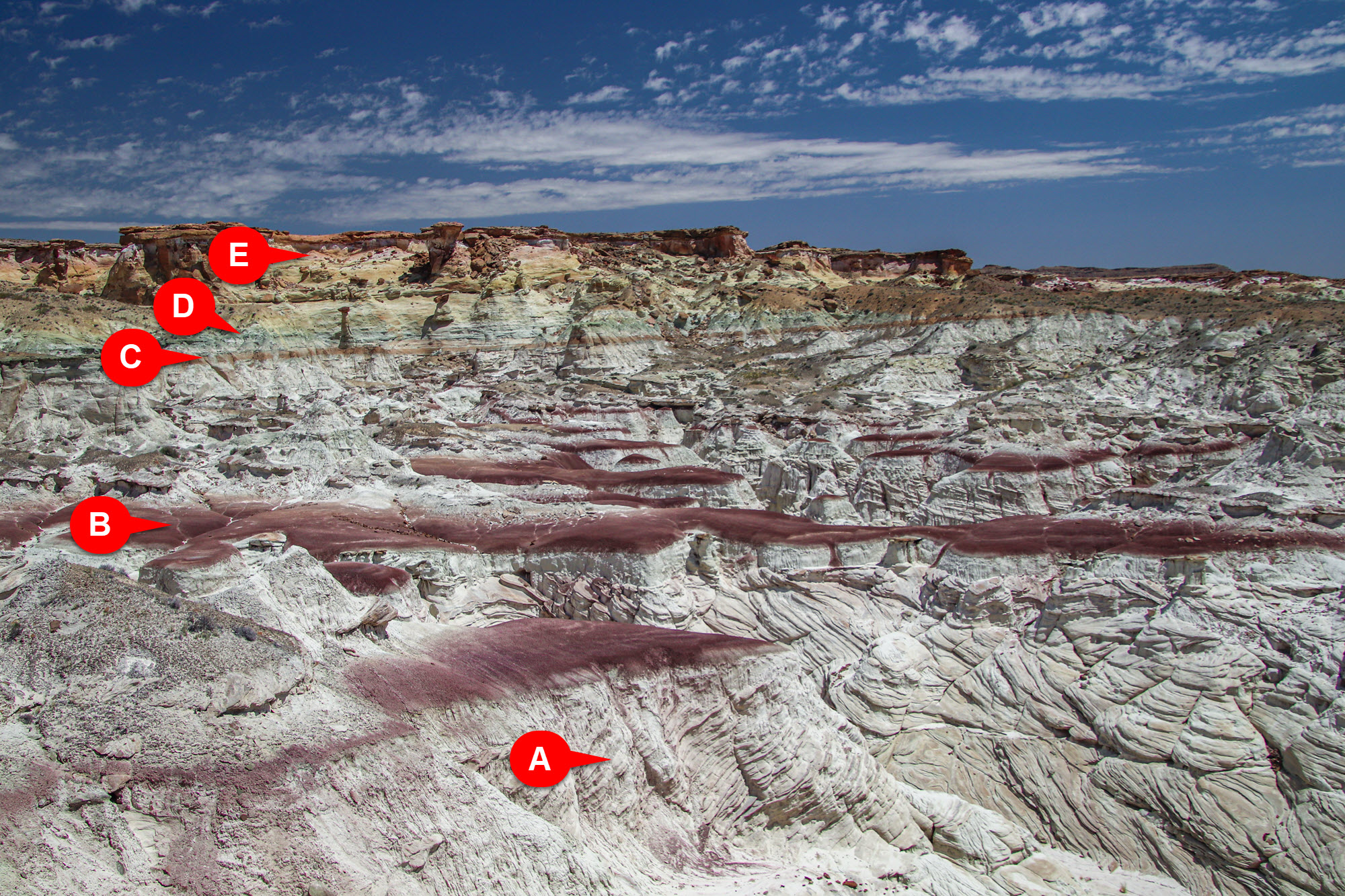
Looking from the bottom up, one can see the various “members” of the Entrada Sandstone Formation. These members each consist of different “versions” of Entrada Sandstone. Across the Southwest, where the Entrada is exposed, geologists have identified about 12 different members. No more than three or four members are exposed in one locality. In the White Rocks locality, supposedly three are exposed.
Regardless of geology involved or these different members, this scene is very impressive. It shows many of the layers or bands of rocks, along with their unique colors, that are found all over White Rocks. Some of these bands are the stripes that make up Zebra Hoodoo and other hoodoos found in Sidestep Canyon.
Using the labels in the above picture, they point out:
- A: Cross-bedding of the Entrada
- B: Purple deposits found in White Valley
- C: Reddish stripe found in Zebra Hoodoo
- D: The thin green stripe towards the top of the Entrada that’s found in places
- E: The yellow and pink rocks on top
“E” is the cap rock of the Naturita Formation (not part of the Entrada) that can be seen at the top. The Naturita is made of tougher material than the Entrada. This is most likely the source of the “hats” on many of the toadstools.
Photography
The potential for capturing artistic photography at White Rocks is endless. During our travels to White Rocks, we’ve discussed it might be possible to open an art gallery that consists of nothing but pictures of White Rocks, where each picture would showcase something different. Some of the scenes are so abstract and surreal that it would be easy to meet that goal.
The easiest place to access White Rocks when carrying a lot of photography equipment is the small valley of Zebra Hoodoo. When photographing the cliffs surrounding this valley, it is important to capture its scale, such as using a person or something recognizable. Because the cliffs contain many intricate and whimsical features, a moderate zoom lens will come in handy to capture the detail. A wider-angle lens will miss the details.
White Valley contains a different environment and landscape to photograph compared to Zebra. It is also easy to access with the exception of getting past the rancher’s dam. It’s also a longer hike (about 3-5 miles). Once can easily spend a lot more time in White Valley compared to Zebra.
Like White Valley with its different landscapes, Sidestep Canyon has again a whole different landscape profile. It has more nooks and crannies to explore for finding that unique and perfect image. However, it’s certainly more difficult to access areas within Sidestep Canyon. Plus, it’s a longer hike, about 6-8 miles. We recommend carrying a lighter camera and less or lighter equipment.
Lighting can be a challenge in different parts of White Rocks. Naturally, the various slot canyons can be dark. But the upside to the white Entrada is that it bounces a lot of light into darker areas. In the Zebra drainage, mornings are better for photographing the west cliff faces, whereas the more intricate east cliff face doesn’t get exposed to the sun until late morning. Various portions of White Valley and Sidestep Canyon are exposed to the sun most of the day. In the tighter places within Sidestep Canyon, the light constantly changes throughout the day. When photographing the narrower canyons, it would be best to visit the same places at different times of the day to capture the best lighting.
Comments
Questions? Would you like to provide what you know about White Rocks and its geology? Read and leave comments about this post on YouTube.
Support Us
Help us fill up our tank with gas for our next trip by donating $5 and we’ll bring you back more quality virtual tours of our trips!
Your credit card payment is safe and easy using PayPal. Click the [Donate] button to get started:
Subscribe
See all our comprehensive virtual tour guides at:
![]()