Grand Staircase-Escalante National Monument
The Grand Staircase-Escalante National Monument (GSENM) covers a large area encompassing many different scenic areas and unique places of interest all nestled in south-central Utah. GSENM’s large size and and wide diversity often makes it misunderstood, simply because there’s so much to know and absorb. The video that accompanies this article (see below) will hopefully clear up some of the confusion by explaining its many of facts and features, as well as showing how various places inside GSENM look.


In This Article
- Introduction & Overview
- Getting Around (the roads)
- Geology (What is the Grand Staircase?)
- Places to Visit – other videos
Introduction & Overview
The video explains more detail on the background, history, and development of GSENM. This section summarizes the introduction.
How did it get its Name?
The word “Grand Staircase” comes from large geologic formations, which appear as large steps on the Earth’s surface. They come up from the Grand Canyon, which is the beginning of the staircase, and end at Bryce Canyon, which is the top.
The word “Escalante” initially came from the name of the first European explorer to this area, Silvestre Velez de Escalante. He was part of the Domínguez–Escalante Expedition that took place in 1776. Their route however did not come through the present-day monument. It went around it. The town of Escalante initially got its name from Silvestre, that was later inherited by the monument.

National Monument Status
The idea of creating some sort of national monument or preserve covering portions of this area initially began in 1934. It became reality in 1996 with the boundaries that are in place as of 2024.
There was some contention when the monument was formed in 1996. President Clinton promised that he would sit down with Utah officials to discuss details and hear feedback about the proposed monument before he signed anything.
Later, on the same day he said this, he signed the monument into law. He also held the signing ceremony on the south rim of the Grand Canyon, which is in Arizona, not in Utah or inside the current-day monument, fearing local protests.
Up to this point, the state of Utah was already unhappy with its large proportion of Federally-control lands that it has little say over. The monument would be the biggest ever created in the USA at that time. Many officials questioned if using the Antiquities Act of 1906, normally used for protecting small portions of historic lands, even applied to bringing such a large portion of land under Federal control.
The below map of the USA shows Federally-owned land in red. Notice states Nevada & Utah:

On the flip side of the controversy, there are certainly a lot of gems to protect inside this large region. It does seem like it would be difficult to create many small monuments to protect those many gems. Creating a large monument seemed logical.
Also, in the early 1990s, significant paleontological discoveries were being made in the Kaiparowits Plateau section of GSENM of the remains of animals that lived during the Cretaceous Period (145 to 66 million years ago). Large coal seams were discovered on the plateau in the 1960s and were earmarked to be mined, which would result in land potentially containing a large amount of irreplaceable fossils to be upheaved. Creating a national monument would provide more control over how the land was used.
After the monument’s creation in 1996, the people of Utah continued lobbying government to decrease the size of the monument on account of all the land no longer being in State control. When Donald Trump was selected president in 2017, Utah government officials were previously encouraging him to take action. In turn, President Trump reduced the size of the monument by roughly half after he was elected. This was done by splitting the monument into three separate monuments: 1) Grand Staircase, 2) Kaiparowits, and 3) Escalante Canyons. Four years later however, in 2021, when Joseph Biden was elected, he restored the monument to its 1996 borders.
Monument Sections
As mentioned above, in 2017, the monument was broken up into three sections. This is because early on and before the monument was created in 1996, three very distinct sections of GSENM were noticed. They are:
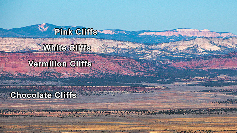
- Grand Staircase: these are long steps of geologic formations that come up from the Grand Canyon, each representing periods of time in Earth’s history. The Grand Staircase extends from US 89 in the south with the Chocolate and Vermilion Cliffs, and ends at Bryce Canyon National Park in the north with the Pink Cliffs, with the White and Gray Cliffs in the middle.
- Kaiparowits Plateau: a very large distinct plateau that has been pushed up through geologic forces and have exposed very large number of in-tact fossils of animals that lived during the Cretaceous Period.
- Escalante Canyons: a very scenic, colorful and rugged landscape mainly consisting of sandstone and deeply eroded canyons.
Monument Management & Visitor Centers
Before 1996, a majority of national monuments were managed by the National Park Service, with some managed by the National Forest Service. GSENM is one of the first national monuments to be managed by the Bureau of Land Management (BLM). After 1996, as more national monuments were formed in Utah, Nevada and Arizona, they too would be managed by the BLM.
Initially, an existing BLM visitor center in Kanab, Utah was used as the GSENM’s primary visitor center. Later through the years, four more visitor centers would be built. Those visitor centers are:
- Kanab/GSENM Visitor Center at 745 US-89, Kanab, UT 84741
- Kanab BLM Paria River District Office at 669 South highway 89A, Kanab, UT 84741
- Big Water Visitor Center at 20 S Revolution Wy, Big Water, UT 84741
- Escalante Interagency Visitor Center at 755 W Main St, Escalante, UT 84726
- Cannonville Visitor Center at 10 W Center St, Cannonville, UT 84718
The visitor center at Bryce Canyon National Park also has a lot of information on the Grand Staircase. It actually has the best real-live relief map in the visitor center showing the full aspect of the Grand Staircase, as shown in the video.
More…
Support Us
Help us fill up our tank with gas for our next trip by donating $5 and we’ll bring you back more quality virtual tours of our trips!
Your credit card payment is safe and easy using PayPal. Click the [Donate] button to get started:
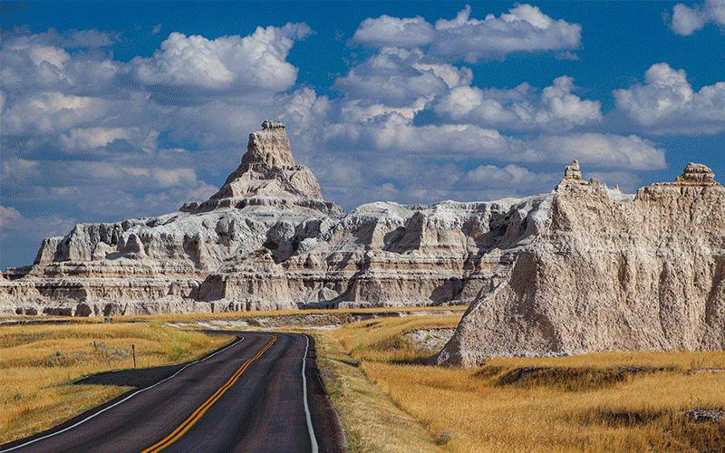
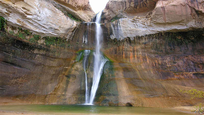
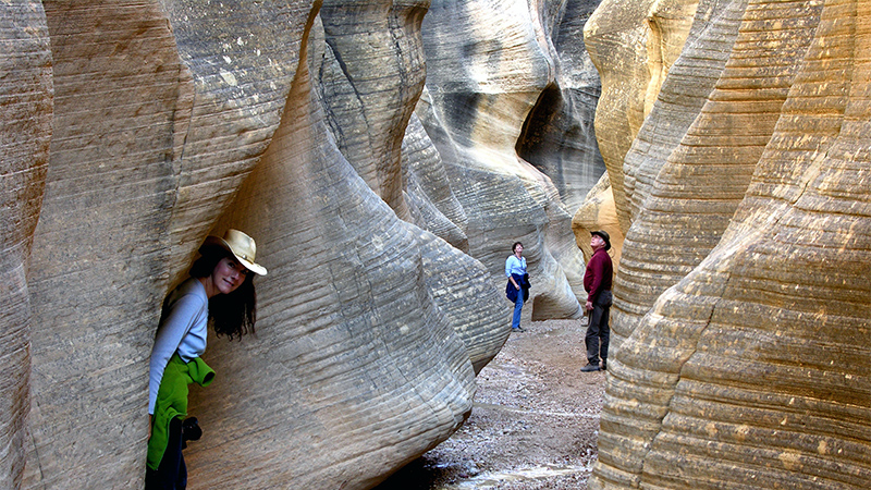
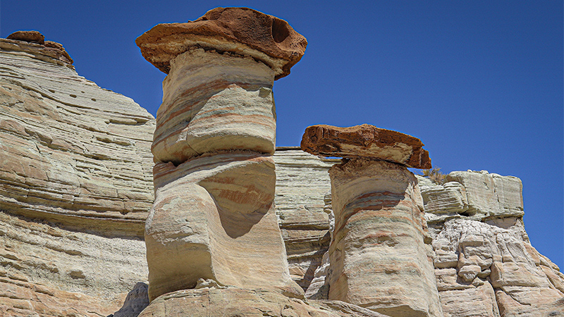
Pictures
Below are some pictures of what you will see along the way.


Getting Around
The monument can be explored using a series of roads. There are only two paved roads that can be traveled by any type of vehicle. There are numerous dirt roads, some of them requiring your vehicle to be equipped with high-clearance and four-wheel drive. Remember that the monument is very remote, so make sure your vehicle is in good running order and is fueled up.
The Paved Roads
For such a large monument, only two paved highways traverse the monument in an east-west direction. In fact, one of the highways, US 89, doesn’t pass through the monument but acts somewhat as its southern border. The other highway, Utah State Route 12, is a National Scenic Byway and traverses the northern end of the monument. SR 12’s full name is A Journey Through Time Scenic Byway.
Dirt Roads
The monument is bisected by several dirt roads trending in a north-south direction. These roads are administered by the BLM who gave them an easy to remember numbering sequence. It starts with 100 in the very east and 600 on the very west.
Road 100 is known as the Burr Trail. It access these areas and points of interest:
- Long Canyon
- The Gulch
- Circle Cliffs
- Wolverine Loop
- Wolverine Petrified Wood Natural Environmental Area
- Capitol Reef National Park
- Burr Trail switchbacks
Road 200, Hole-in-the-Rock Road accesses these areas:
- Big Horn slot canyon
- Zebra & Tunnel slotcanyons
- Devils Garden
- Twenty Mile Wash Dinosaur Track Site
- Egypt trailhead & slot canyons
- Dry Forks, Peekaboo, & Spooky slot canyons
- Coyote Gulch
- Dancehall Rock
- Hole-in-the-Rock (Lake Powell)
Road 300, Smokey Mountain Road accesses:
- Alvey Canyon
- Kaiporwits Plateau
- Smokey Hollow Road
- Kelly Grade
- Nipple Bench
- Lake Powell – Alstrom Point
Road 400, Cottonwood Canyon Road accesses:
- Kodachrome Basin State Park
- Road Valley Draw slot canyon
- Grosvenor Arch
- Cottonwood Narrows
- Lower Hackberry Canyon
- Yellow Rock
- Paria Box
Road 500, Skutumpah & Johnson Canyon Roads both access:
- Willis Creek slot canyon
- Bull Valley Gorge
- Lick Wash
- Johnson Canyon
- Gunsmoke movie set
Map
Below is the road map supplied by the BLM showing the 2024 borders. Click the map to open a larger version for downloading.

Geology – Resources
Use the video to get a good understanding about the geology of all three sections of the monument. The animations and pictures are no match for written text!
The video makes use of various cross sections and maps. Those and more are available for viewing and to download below and make for great resources when learning about all the geology that there is to see in GSENM.
Grand Staircase Cross-section
When explaining the Grand Staircase, the video uses the following cross-section that points out each of the geologic formations making up each step in the staircase:

The above cross-section is part of short paper entitled What is the Grand Staircase? Use this link to download a PDF copy.
Below is another artist’s cross-section rendering of the Grand Staircase. This particular cross-section has been for sale in various visitor centers throughout Southern Utah. It is available to the public domain on Wikipedia.
In this cross-section, each of the red dots point out each of the steps discussed in the video.

Geology of the Kaiparowits Plateau
How do you pronounce Kaiparowits? Kaa-parr-o-wits. Easy, right?
The Kaiparowits Plateau is a special place in more ways than one. Recent discoveries (starting in the 1990s) of animal fossils from the Cretaceous Period has overshadowed the story behind the Kaiparowits. However, this plateau is like a miniature version of the Colorado Plateau (which the Kaiparowits sits on top of). This entire plateau was evenly and consistently pushed up over a 1,000 feet (300 m), then erosion exposed many of the plateau’s geologic formations.
The Utah Geologic Society publishes many maps and papers covering a myriad of geologic-related topics. One of the papers they published covers the geology of the Kaiparowits in great detail, including a very detailed geologic map. Use this link to download a copy. BEWARE! The PDF is 41 MB large and might take some time to download.

Places to See
There are a lot of places to see in GSENM! It’s impossible to cover them all in this one article, so we’ve included a few resources that may help you plan your next trip.
Geology Field Trips
The Utah Geologic Society, along with several other agencies, published an outstanding road guide back in 2000. Although it focuses on geology, it also covers many places to see along the roads it covers.
The guide covers many of the roads in GSENM, including US 89 and SR 12. Each chapter explains where to find places along each road using using the trip odometer on your car (providing you reset it to zero at the beginning of the trip).
Use this link to download a PDF copy of the road guide.
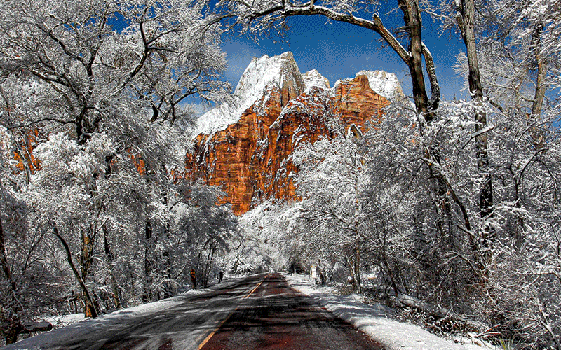
Other BackRoadsWest.com Articles on GSENM
- Burr Trail
- Kaiparowits Plateau Road Trip
- Willis Creek Slot Canyon
- Fall Colors in Southern Utah
- Bryce Canyon in the Snow
Comments
Read and leave comments about this post on YouTube.
Support Us
Help us fill up our tank with gas for our next trip by donating $5 and we’ll bring you back more quality virtual tours of our trips!
Your credit card payment is safe and easy using PayPal. Click the [Donate] button to get started:
Subscribe
See all our comprehensive virtual tour guides at:
![]()