Tybo Ghost Town and Project Faultless
Length
10 miles (16 km) one-way
(from pavement of Hwy 6)
60 miles from Tonopah, NV
Attractions
- Nuclear test base camp
- Historic old buildings
- Mining artifacts
- Charcoal kilns
- Remote mountain scenery
Difficulty
- All dirt roads
- Good road to town
- Rough road to kilns
Elevation Gain
- Begins at 5,223 ft
- Ends at 7,047 ft
Beginnings
Precious metals were discovered in the Hot Creek Mountains in Central Nevada around 1870. Tybo, which in Shoshone, the local Native American language in this area, means, “white man’s district”. Supposedly, it was a Native American that showed prospectors in the area a suspicious-looking rock. A mining camp was established in 1871 and a smelter was built a year later. By 1874, Tybo become a true town with a population of about a thousand. By 1876, more amenities were built, including a school, post office, a bank, a Wells Fargo Office and, of course, many saloons.
In 1881, the ore began fading and the largest mining company and employer, Tybo Consolidated Mining Company, closed. It didn’t take long for Tybo’s population to dwindle. Little than a hundred residents remained. Many of Tybo’s 32 buildings were later destroyed by a fire in 1884. This seemed to spell the end of mining in Tybo.
But just like with other mining towns, diehard miners came back to take another try and began to find other veins. Through the early 1900s, several companies made attempts to recover more precious metals but all of them failed. Tybo’s mill closed in 1937 but one company insisted on mining and shipped their ore to Tonopah, about 60 miles away, for milling.
Mining Ends
When World War 2 came along, the demand for lead greatly increased and the mines prospered between 1942 and 1945. In the end, the combined mining in Tybo produced about $9.8 million in silver, lead, zinc and some gold.
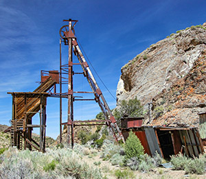
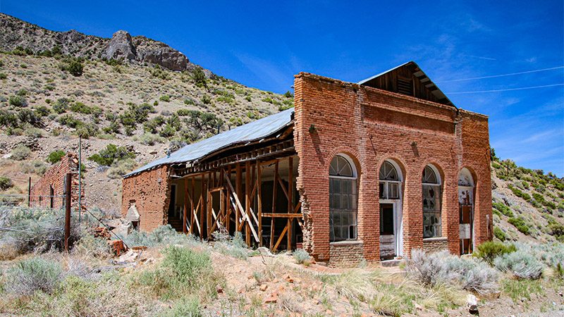
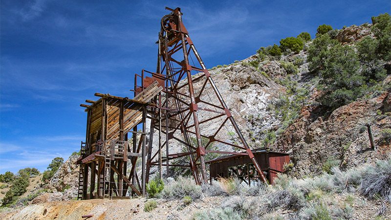
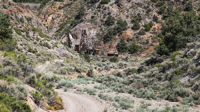
Today, Tybo is a classic mining or ghost town with several buildings in various stages of decay, two headframes, and the remains of smelters along with their slag heaps and tailings. There are also a number of residences located in and around the town. Electric power is still available here and serviced by the power line seen when driving up to Tybo.
Since we are avid history seekers and photographers, we really enjoyed seeing these old buildings and relics. It’s always a joy to be the only people wandering around a historic site where hundreds of people were once hard at work.
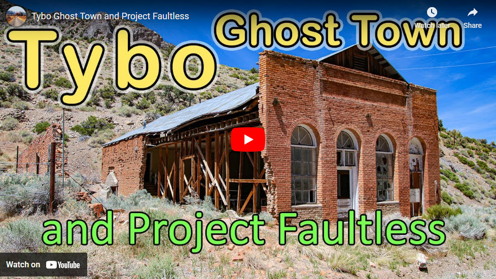
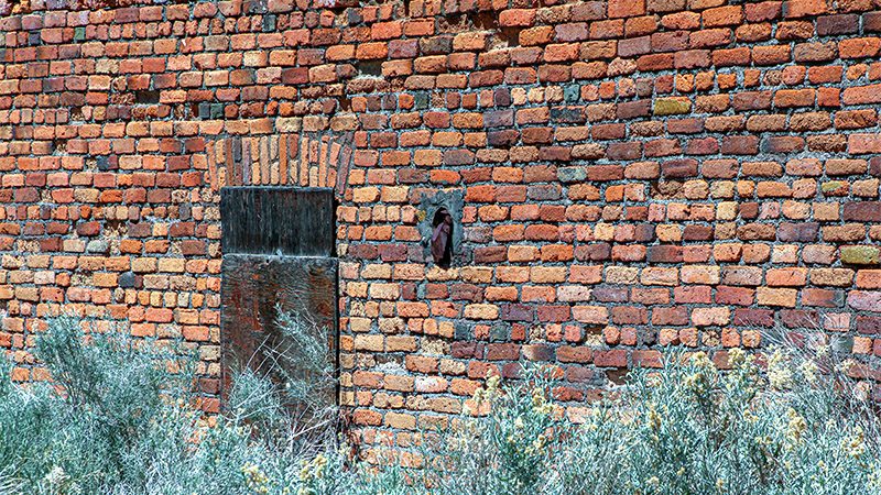
The crown jewel of Tybo is the general store that contained a Wells Fargo office. Its brickwork is a testament to 1800s western architecture. Other nearby buildings share similar brickwork. Thanks to the residents that live here and act as caretakers, Tybo will hopefully remain preserved for many years.
More…
Support Us
Help us fill up our tank with gas for our next trip by donating $5 and we’ll bring you back more quality virtual tours of our trips!
Your credit card payment is safe and easy using PayPal. Click the [Donate] button to get started:
Pictures
Below are some pictures of what you will see along the way.
Getting There
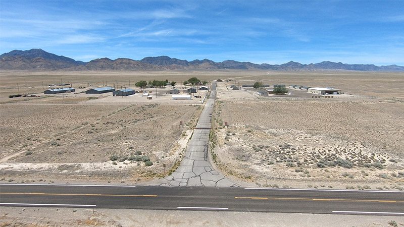
Tybo is reached from a dirt road off US Highway 6. The turn-off is about 60 miles east of Tonopah. The road to Tybo is easy to find, as the junction is next to a cluster of buildings located in a very large, empty valley. On most maps, these buildings are labeled as “Central Nevada Base Camp”. The road will pass right through the camp.
Visiting Tybo can easily be combined with a trip along the Extraterrestrial Highway. See our article on the ET Hwy for details. Another nearby historic mining town to visit is Goldfield.
Next Nuclear Test Site
The cluster of buildings at the turn-off are used by the U.S. Air Force to test radio and communications for nearby military installations such as the Nevada National Security Site, Tonopah Test Range and Area 51. Originally however, this camp was built to operate the next nuclear test site.
In the 1960s, nuclear testing was at its height. Most of the testing was done about 75 miles northwest of Las Vegas at Yucca Flat. By this time, Vegas was growing in both population and as a popular tourist destination. When nuclear detentions occurred at the test site, they created earthquakes ranging in 5 to 6 on the Richter scale. The residents and visitors in Vegas were commonly woken from their sleep as nuclear tests were conducted in the early morning hours. Although the nuclear tests were somewhat of a tourist attraction, as the mushroom clouds could be seen from Vegas, the residents became increasingly annoyed.
Many influential people, mainly Howard Hughes, urged the department of defense to move their testing area further away from Las Vegas. The Atomic Energy Commission agreed and began looking for a new spot further north of the current Nevada Test Site. They decided on Hot Creek Valley.
The facility that we’ll pass through was the result of searching for a new spot. The base camp would serve as an operations center for the new testing site. Project Faultless, the first nuclear test here, was conducted about 25 miles to the north. When the test took place in 1968, it was learned that Hot Creek Valley’s geology is a bit unstable, as the detonation caused a large area to sink by eight feet. This didn’t happen at Yucca Flat. Since the base camp was already built, the military continued to use it and it is what you will see today.
Visiting Tybo
Continuing up the road past the camp another 8.5 miles will lead you to Tybo. You’ll begin to see the ruins of two smelters and then see several old buildings, the biggest being the general store. You’ll also see a couple of residences.
Continuing past the general store, the road becomes more narrow and rough. A 4WD vehicle should be used. A vehicle with low-clearance will most-likely get damaged.
A quarter of mile past the town, a headframe will be seen on the left. This is one of two headframes that was built during Tybo’s last mining efforts of the 1940s. They were part of the Treadwell Yukon Mine.
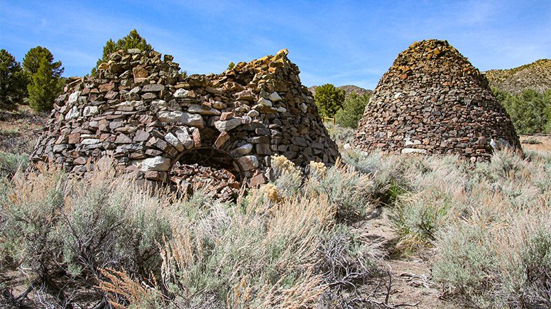
About a mile and a half further up the road are the remains of charcoal kilns built during Tybo’s first mining rush of the 1870s. Look for a road that leads to the left over a hill that is badly eroded and not drivable. Park your car here and walk the quarter of a mile on the eroded road to the kilns. There are two of them. One is collapsed. The kilns were used to create charcoal for the smelters back in Tybo. Incidentally, there are several charcoal kiln sites located in the Hot Creek Range.
Trip Map
To help plan your trip, use our interactive Google Map below. Be sure to switch to Satellite view to see the terrain.
Learn more about our maps.
Comments
Read and leave comments about this post on YouTube.
Support Us
Help us fill up our tank with gas for our next trip by donating $5 and we’ll bring you back more quality virtual tours of our trips!
Your credit card payment is safe and easy using PayPal. Click the [Donate] button to get started:
