Twin Point: Little Known Overlook of the Grand Canyon
Twin Point is a seldom-visited viewpoint overlooking the north rim of the Grand Canyon. The drive to get there takes you through part of the Arizona Strip and the fairly new Grand Canyon-Parashant National Monument. Making the trek to Twin Point from St. George, Utah can be a day trip or you can include it as a multi-day camping trip to see the many interesting sights within the Parashant. Either way, you’ll be rewarded with a stunning view of the Grand Canyon without all the crowds.

Trip Specs
Arizona Strip
The Arizona Strip is a remote stretch of high desert sandwiched between the Grand Canyon and the Utah border. It is home to three national monuments, one of them being the Grand Canyon-Parashant. St. George is the nearest town to the Parashant and is the starting point for our trip. Since we live nearby, we chose to make it a day trip but there are plenty of places to camp along the way. Camping is the best way to spend time and really explore this area. Just make sure that you are well supplied because there are no towns, businesses, eateries or gas stations between St. George and the Colorado River. None. This is a very remote area.
Before starting any trip into the Parashant or the Strip (as the locals call these areas), we highly recommend a stop at the BLM Interagency Visitor Center in St. George. It’s easy to find by taking the Bluff Street exit off I-15, turn east and then follow the brown signs leading to the center at 345 E Riverside Drive. Here you’ll find plenty of information including an excellent (and free) map of the national monument plus knowledgeable staff that can tell you just about anything you want to know about the Arizona Strip and Southern Utah. Be sure to tell them you’re heading to Twin Point so that they can tell you about road conditions. And before leaving St. George to start this trip, be sure your gas tank is full and you’ve got lots of drinking water.
We don’t recommend taking this trip during the winter or summer months. During winter, snowfall will accumulate above 5,000 feet and make the road extremely muddy – so muddy that 4WD vehicles are useless. During the summer months, the monsoon season brings brief periods of heavy rain that can also create muddy conditions. Plus, it will be quite hot out on the Arizona Strip in the summer.
Trip Begins
Start your trip to Twin Point by taking Southern Parkway (which is Utah State Route 7 located just south of St. George on I-15) to the River Road exit (about 3 miles east of I-15). Turn right at the bottom of the exit and say goodbye to the pavement. This will be the last time you’ll see it on this trip. Where the pavement turns to dirt marks the Utah-Arizona border and is the beginning of road 5. Road 5 is also known as the Mt. Trumbull Loop which leads to a famous Grand Canyon overlook along with other interesting places. That’s a trip for another day.
Why is it called River Road? River Road is a major north-south arterial road through St. George. Heading south on it for over 100 miles will eventually lead you – to the Colorado River. But our trip will only take a portion of the River Road route.
From the end of the pavement, it’s 90 miles one-way to Twin Point. Yes, that means it’s 180 miles round trip, on a dirt road, to return to this point. So if you’re making this a day trip, we suggest you get an early start if you don’t want to drive back in the dark. And be sure to have everything you need (food, water, etc.) for a full day in this isolated area.
More Info
It is important to stress again that the trip to Twin Point passes through a very remote area. A few suggestions on planning your trip:
- Try to go with two or more vehicles, like we did. That way, if someone gets stuck or breaks down, a backup vehicle is available.
- Let someone know where you are going and when you’ll be back. That way, if you don’t return, that person will know you need help. When you return however, don’t forget to call that person to inform them you returned safely!
- Go prepared with supplies to last you 2-3 days. The roads in the Arizona Strip are not traveled often and, if you get stuck or breakdown, it might take a day or two for someone to finally drive by and help you.
Here is some more resources to look at and help you plan your trip:
- Grand Canyon-Parashant National Monument website: https://www.nps.gov/para/index.htm
- Regulations on ATVs/OHVs: https://www.nps.gov/para/ohv-regulations.htm
- Camping regulations: https://www.nps.gov/para/planyourvisit/camping.htm
- BLM St. George office: https://www.blm.gov/office/st-george-field-office
Pictures
Below are some pictures of what you will see along the way.
ADVERTISING SPACE AVAILABLE
.
Advertise on our website! For more information, please contact us.
We can provide website visitation statistics and advertising rates.
.
Virtual Tour on YouTube
Make sure to watch video in full screen mode and HD 1080p quality!
Wolf Hole, Mainstreet Valley
As you continue on the well-defined road 5, you’ll go over the 5,000-foot-high Quail Hill Pass and come upon the site of an old settlement named Wolf Hole in about 20 miles. Continue south through Mainstreet Valley, with the 100+ mile-long Hurricane Cliffs in the distance, and at 38.3 miles, turn right onto road 103. The terrain will change from high desert to juniper tree forestland.
At about 53 miles (still on road 103), you’ll see the signs for and cross the boundary into the national monument. At 55 miles a road junction is reached and you will continue south on road 103. Turning right will take you on a scenic drive into Hidden Canyon. As you head south on 103, you’ll pass by a few very remote cattle ranches and the vegetation changes back and forth between junipers and Ponderosa pine tree forests.
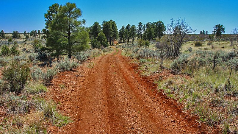
Finally, at 75.5 miles, bear right onto road 1019. No more road directions are required after this turn because road 1019 will take you all the way to the overlook. From this point on, be prepared to engage your 4WD depending on road conditions. When we went, there were just some deep ruts in the road that we easily avoided. If you were to continue on road 103, it would take you to another overlook of the Grand Canyon called Kelly Point. This stretch of the road is very rough and much longer and is better traveled using an ATV, mountain bike or on horseback.
At 76.2 miles, you’ll pass a deserted outpost called Oak Grove. Here, you’ll find some ruins and a plaque explaining what was here. You’ll also pass a few hiking trailheads that lead to other overlooks of the canyon. We have yet to check these out. Continuing on 1019, you’ll pass through denser Ponderosa forest, cross over the boundary into Grand Canyon National Park and then it becomes very bright through the trees on the right. That’s because you’re nearing the rim edge of the canyon.
First View of the Grand Canyon
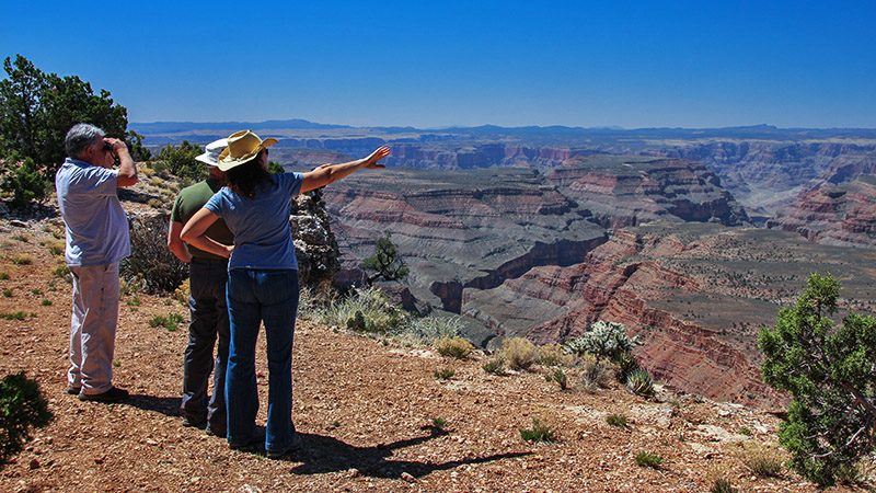
At about 85.5 miles, you’ll find a turnout on the right. Don’t drive too far in because there are no guardrails to keep you from falling into the canyon! At this first viewpoint of the canyon, you will be directly across the canyon (due west) from the Grand Canyon Skywalk. On the other side of the canyon, you’ll see an airstrip with some buildings nearby on the rim. Using binoculars, you’ll be able to see the actual skywalk that people pay $80-100 to walk on. If it’s before noon, you will be able to see the skywalk’s shadow cast on the canyon wall below.
The road continues along this rim edge for about 2 miles which makes driving interesting knowing that there’s a big chasm just off of your right side. For people with a fear of heights though, don’t worry because there are many big trees between the road and you and the drop-off. Finally, the road ends at 90 miles from the pavement.
Road’s End
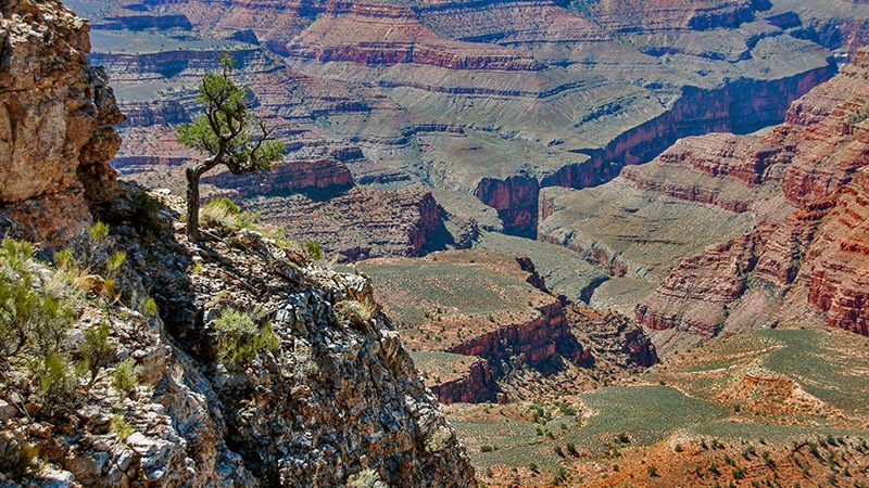
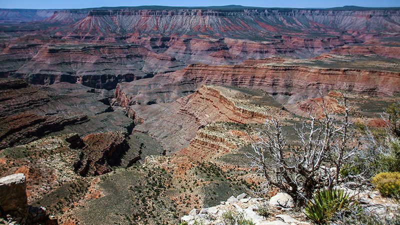
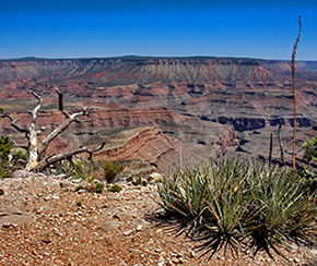
Twin Point is actually a long peninsula jutting out into the canyon. Unlike views of the canyon you saw at the previous turnout, which were to the west, Twin Point offers views to the south and east. You won’t be able to see the skywalk from here and, unfortunately, you also won’t be able to see the Colorado River below. Actually, you won’t be able to see the river from anywhere on this trip.
Once you’ve fully enjoyed the views and wandering around (we stayed for at least an hour and ate our lunch), return back to St. George using the same route you drove in on. Other than the two vehicles we were traveling with, we didn’t see any vehicles after turning off road 5. If you got an early start, you can probably take an alternate route back to St. George by going through Hidden Canyon and connect back to road 5 at Wolf Hole.
See what Twin Point, as well as the journey to get there, looks like by taking our virtual video tour. And check out the animated map to get an idea of the expanse and remoteness of the Arizona Strip. You’ll find all this and more on our website: www.BackRoadsWest.com/blog, then search for “Twin Point”.
Support Us
Help us fill up our tank with gas for our next trip by donating $5 and we’ll bring you back more quality virtual tours of our trips!
Your credit card payment is safe and easy using PayPal. Click the [Donate] button to get started:
