Tushar Mountains Road Trip
You’re probably thinking right now, where are the Tushar Mountains? The Tushar Mountains are the third highest mountain range in Utah and are located about 100 miles northeast of St. George, just east of the town of Beaver, along I-15. Of the several high peaks within the Tushar range, Delano Peak is the highest at 12,174 feet. The name “Tushar” comes from an ancient Indian or Hindu word meaning “snow”, something that the Tushar’s get a lot of.

Trip Specs
About our Trip
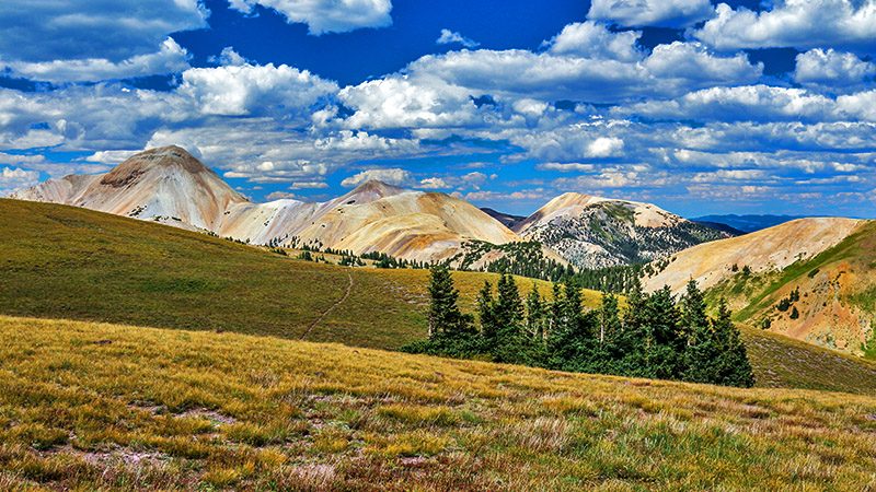
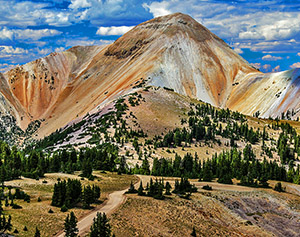
Touring through these mountains was, for us, reminiscent of the colorful Rocky Mountains of southwestern Colorado (the San Juan’s). There is a distinctive timberline and some of the mountain tops have a yellow hue to them. As we passed through these higher elevations, we really got the feeling of being in the San Juan’s. One big difference, though, is that the San Juan’s were heavily mined for gold and silver which means that there were many ghost towns and ruins left behind. Not so for the Tushar’s. There were only a handful of mining operations here.
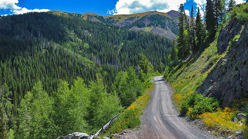
Our tour through the Tushar Mountains starts on their north side, off of I-70, at the exit for the Fremont State Park and Museum. The route we’ll take is about 30 miles long, which doesn’t seem like it would take much time, but it took us most of the day. That’s because the road is slow-going and we stopped to look at the sites along the way. The road is all dirt and should be driven using a high-clearance 4WD vehicle or an ATV/OHV.
As mentioned, the Tushar’s receive a lot of snow so you shouldn’t attempt this trip until after July 1 and before September 15 (unless you like to tackle snow and mud). Our tour ends just a few miles south of the Eagle Point Ski Resort which is a good place to spend the night. That’s what we did so that we could continue our exploration of the Tushar’s the next day. Be aware that, unless you camp, there aren’t a lot of choices for places to stay or eat.
Fremont State Park
If you have a spare hour or two, stop in and visit the Fremont State Park. There are numerous petroglyph panels and Native American artifacts that were all discovered during the construction of the I-70 freeway. The museum is a great resource for information about the Fremont People that used to live here.
If you do visit here and still plan on taking our Tushar Mountain road trip route, then think about limiting your stay to no more than an hour or two because our trip will take a good chunk of the day. We actually made a separate trip to the State Park so that we can spend more time taking in all the sites. There is a lot of different sites to see here and all are different. One can easily spend a half day or more walking all of the well-maintained trails and seeing all of the rock-art sites.
Start of our Road Trip
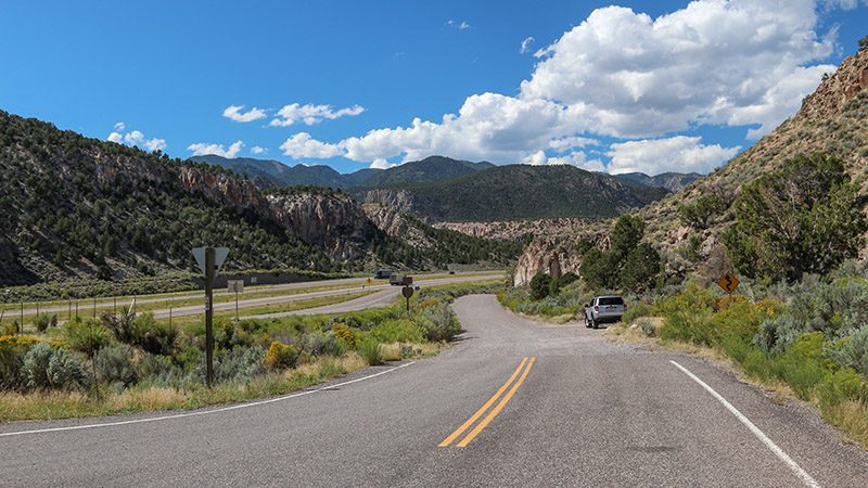
Let’s start our trip. After taking exit 17 off I-70, head a short distance west and then turn left onto road 113. Reset your odometer here and follow along to the places of interest mentioned below. After passing underneath the high bridges of I-70, up a narrow canyon and through a dense pine tree forest, you’ll encounter the remains of an old gold mining area known as Kimberly.
One thing to be on the lookout during this trip is ATVs or OHVs. These smaller vehicles are common on the various roads through the Tushars and move much faster than larger vehicles. The popular Paiute ATV Trail runs along sections of the roads this trip follows. You’ll see the Paiute Trail symbol on many signs along the way. The trail is a 245 mile-long loop.
Kimberly
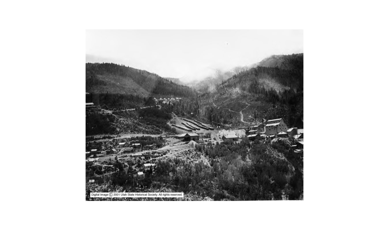
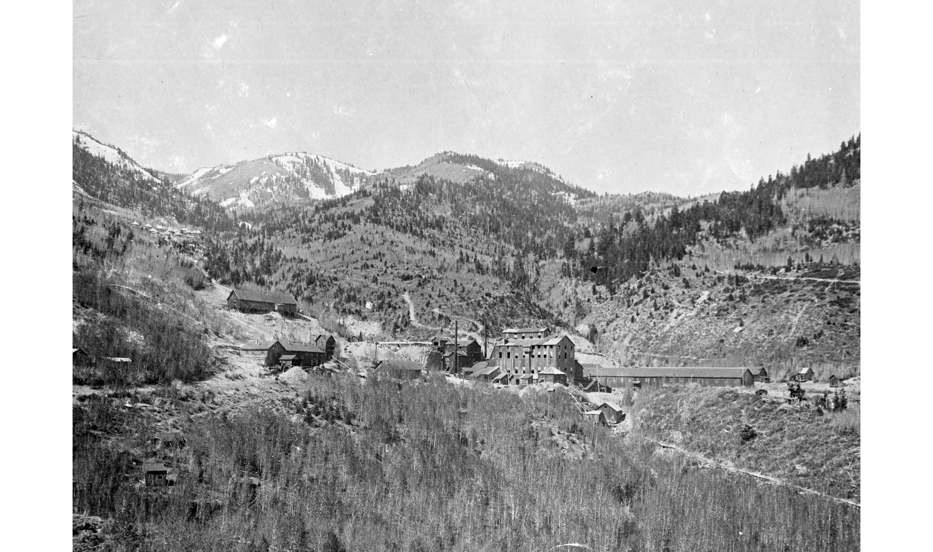
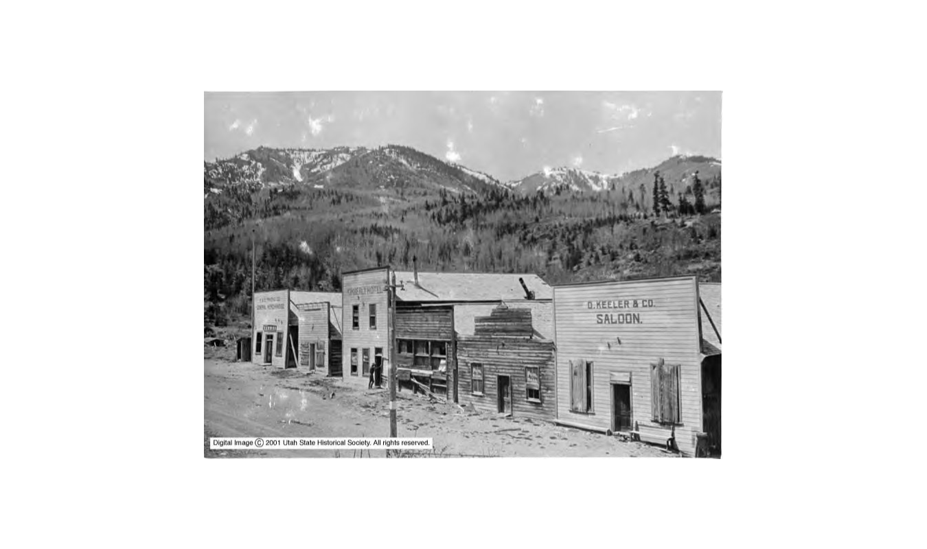
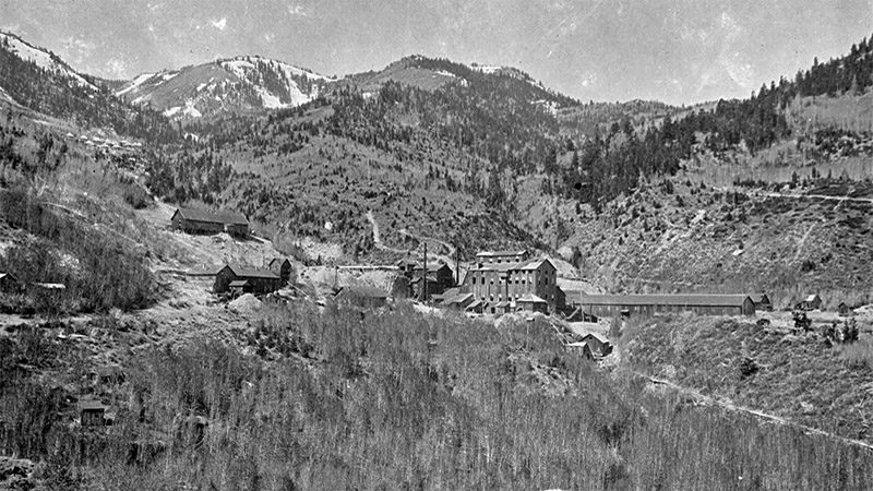
Kimberly is reached in just over 7 miles. This small area prospered from 1890 until 1909. There was a Lower Kimberly and an Upper Kimberly. The town was split into these two sections because of the limited space on the steep slopes of the mountains. At the bottom of canyon was the mining operations, such as the large mill that used to be here.
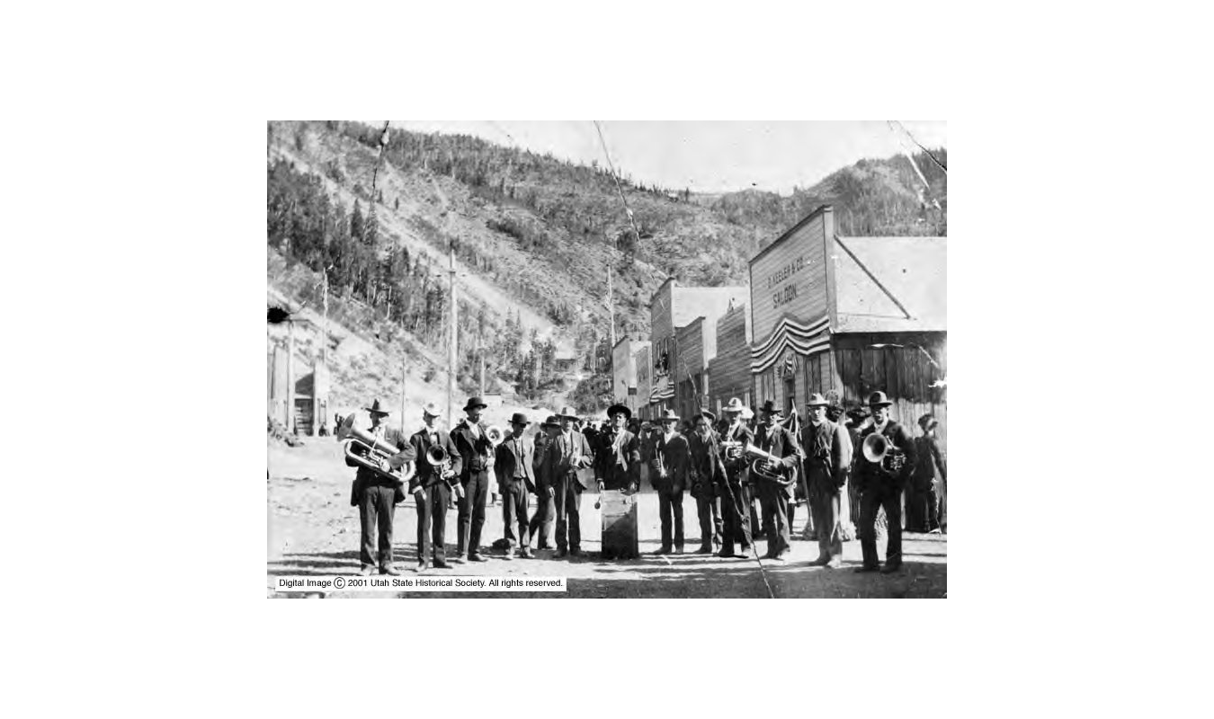
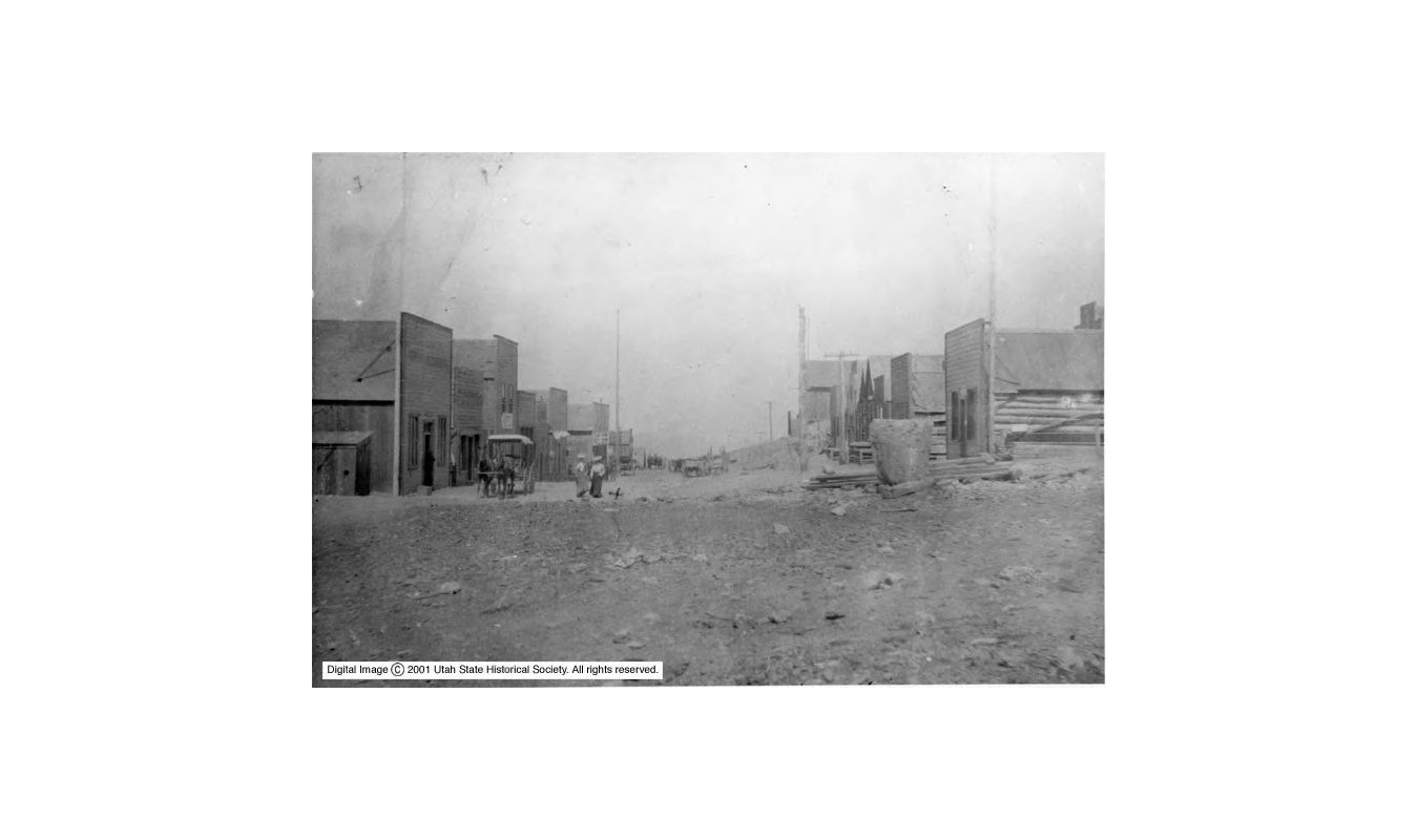
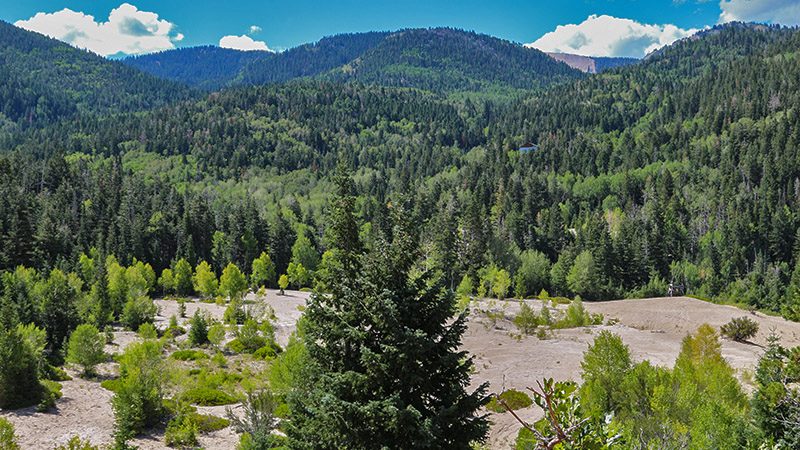
Mining began in 1890 but the boom years were from 1901-08. Some 500 people lived in upper and lower Kimberly during those boom years. Spread across the steep mountainside were many homes, three general stores, three saloons, two hotels and several other businesses. Surprisingly, today there is no evidence that any type of town existed. The only remaining structure today is a metal mining building that is visible from the road and on private property.
Butch Cassidy and his Wild Bunch were seen frequently here. Cassidy grew up nearby (in Beaver and Circleville) and he knew many of the people living in Kimberly. This is probably the reason why there were never any holdups or company payrolls stolen in Kimberly.
Kimberly also had several well-known brothels. The town had several murders occur along with the usual amount of drunken brawls that any mining town of that era experienced. Supposedly, Kimberly had the strongest jail in the entire State of Utah.
Winters were harsh but that didn’t stop those persistent miners from going after the riches they had their sights set on. Kimberly sat at an elevation of 8,500 feet and the Tushar Mountains are famous for their accumulations of snow.
Mining began again in the 1930s when a new vein was discovered. The vein played out in 1938 and most people left after that. The buildings were either moved away or were left for the brutal weather, which didn’t take long to rip the old buildings apart.
Historical pictures of Kimberly - click to view
Winkler Point
Continuing up road 113, at 10.1 miles you’ll reach Winkler Point. This viewpoint offers views into the vast Great Basin Desert to the west. It is one of several great viewpoints along this trip. On a clear day, you can see Wheeler Peak (inside Great Basin National Park in Nevada) which is 100 miles away. Make sure to stop here and take in the views into the wide open spaces.
Winkler Point was named after Ernest Winkler (1877-1936). He was the supervisor of the Fishlake National Forest, which the Tushars are located in, from 1913 to 1916.
Silver King Mine
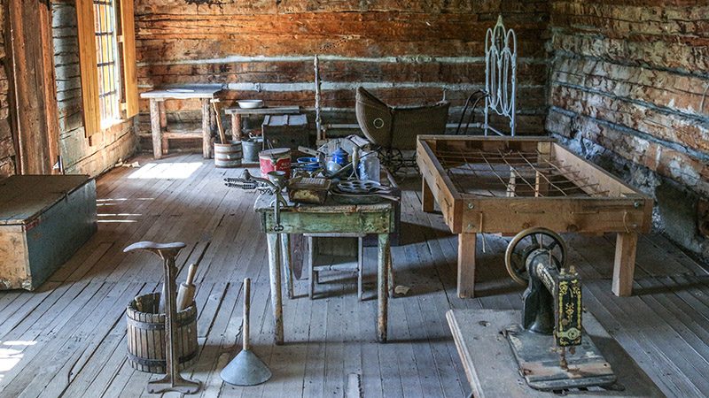
At 11.6 miles, you’ll arrive at the small mining camp of the Silver King Mine. Ironically, more gold was extracted here than silver. Locals have done a great job of preserving this camp and there is more to see here than at Kimberly. A brochure is available at the parking area that explains what to see along the quarter-mile interpretative trail. The couple that operated this mine lived at this site starting in 1897 and worked the site for several years.
A local historical group from nearby Marysvale built up and maintains this site. They’ve done a great job of building the interpretative trail and bringing back its former life after the previous miners left the property.
The mine was claimed by Brigham “Brig” Daniel Darger and he named it “Silver King” in 1894. Him and his new bride moved to the property after they were married in 1897. They lived in the two-story cabin you see today – they lived downstairs and 6 to 10 hired miners lived upstairs. Brig and his wife went on to have 10 children, so that cabin was well used! The caved in tunnel seen along the trail was a 1,000 foot adit dug into the mountain to extract the ore.
After Brig passed away in 1932 and the mine continued to be worked well into the 1950s. Other than the artifacts that the historical group worked at restoring, just like Kimberly, no other old buildings or ruins remain.
Road Junction
At 14.5 miles, you will come to a road intersection. Continuing on road 113, to the left, takes you down to the town of Marysvale. Reset your odometer, then turn right here, onto road 123, as we continue our trip through the Tushar’s.
The road now begins to climb into the heart of the Tushar’s. It first passes along the steep side of 11,690-foot-high Gold Mountain. The road ascends through the timberline and passes alongside the rugged and even more steep 12,137-foot-high Mt. Balknap at about 5 miles. Looking below the road offers views of meadows and big valleys in the distance.
Pictures
Below are some pictures of what you will see along the way.
ADVERTISING SPACE AVAILABLE
.
Advertise on our website! For more information, please contact us.
We can provide website visitation statistics and advertising rates.
.
Virtual Tour on YouTube
Make sure to watch video in full screen mode and HD 1080p quality!
“Elfenwood” Forest
At around 6.5 miles, you will notice the increasing number of stunted pine trees. Some people call this an elfenwood forest. The trees are shaped by the prevailing winds and only have branches on the downwind side. The elevation here is also close to timber line, which is where trees can no longer live because of the thinner air, which hinders their growth.
A good collection of these trees can be visited at 7.1 miles. Hop over the small wooden barrier on the right side of the road. This area also offers great views of both colorful Mt. Balknap and Mt. Baldy.
A little further down the road you will spot more of the stunted trees. At one point, at around 7.5 miles, there is a beautiful view on the left of Mt. Balknap with patches of elfenforest in the foreground.
Summit
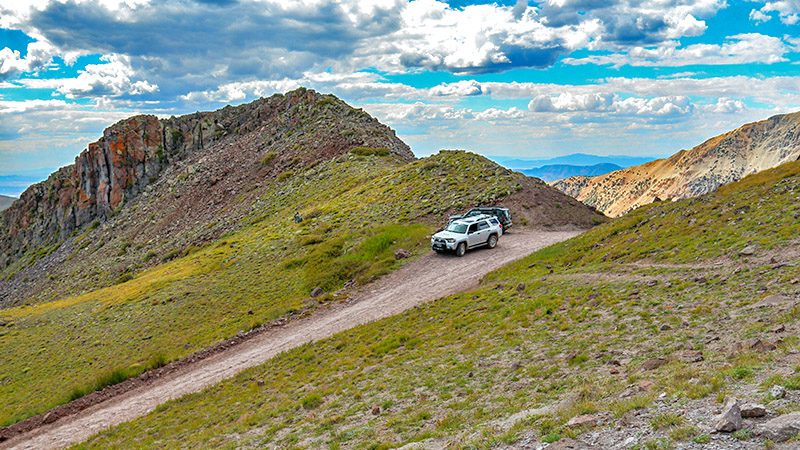
The high-point of our journey is reached at 8 miles. The elevation here is just over 11,400 feet! Stopping here will give you an incredible view in all directions, including the three tall peaks that make up the Tushar’s, as well as distant views of valleys and other mountain ranges looking to the south, including the large valley that the towns of Parowan and Cedar City sit in and also the Pine Valley Mountains near St. George, just over 90 miles away. You can also see the ski runs of Eagle Point Resort just over 4 miles away.
You wouldn’t guess it, but looking straight as the road goes down and then a little to the left, the highest pointed hill on the left of the road, which is just less than 2 miles away, is the tallest peak in the Tushar’s. This is Delano Peak at 12,174 feet. It doesn’t look impressive from this angle, but it sure is in the wintertime when one is driving northbound on I-15 south of Beaver.
A sign here mentions that a herd of White Mountain goats (not bighorn sheep) live here. If you’re lucky, you might see one. Because they are white, they are easy to spot. In the summer, they prefer the ridgeline near Delano Peak. Mountain goats are not originally from Utah. They were brought in from Cascade Range in Washington State in the late 1980s. The herd size is usually around 120 goats.
The small lake you see below is appropriately named Mud Lake. The road passes right by it on the way down and is worth a stop for a closer look.
The Descent
And now for the descent. Road 123 passes by more alpine scenery and meadows as it descends very steeply. Make sure your brakes are in good working order and try downshifting your vehicle to lessen the stress on your brakes.
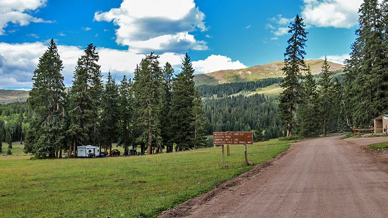
At about 12 miles, you will arrive at the large meadows of Big John Flat. This is a popular camping spot for people that enjoy the outdoors and it’s often a staging ground for those who enjoy exploring the Tushar’s with ATVs and horses. When we passed by here in August, the meadows were very green and patches were covered with yellow flowers.
Road 123 ends at SR 153. Turning right takes you down to Beaver and I-15. Turning left takes you to Eagle Point Resort which has limited accommodations during the summer months. We enjoyed staying here in a one-bedroom condo and ate dinner at their restaurant. Eagle Point rents out all types of condos that include kitchens and living areas and can cater to group vacations. The resort and the Tushar’s in general are a great place to escape the summer heat and is far, far away from the buzz of any populated area. You can easily spend several days here exploring the roads, hiking trails and enjoy the tranquility of this remote mountain range.
Support Us
Help us fill up our tank with gas for our next trip by donating $5 and we’ll bring you back more quality virtual tours of our trips!
Your credit card payment is safe and easy using PayPal. Click the [Donate] button to get started:
