Ghost Town Trail Near Lone Pine
In the Owen’s Valley, about a two hour drive north of Los Angeles near the town of Lone Pine, is a string of “almost” ghost towns that are fun to visit and explore. You’ll also get to experience the views and vastness of Owens (Dry) Lake, the Sierra Nevada and Inyo Mountains – each can take your breath away. You can spend anywhere from a half to an entire day taking this trip. It all depends on how much time you spend looking around each site.
Length
Attractions
- Long scenic views
- Many historic sites
- Desert “artifacts”
- Ghost towns
Difficulty
- Most of trip is on pavement
- Side trip to Cerro Gordo requires 4WD
- Make sure to purchase fuel in Lone Pine
- Remote areas – cell phones will not work
How to find these places
Only a hundred years ago, this area was much different. The Owens Lake wasn’t dry and was more like a large inland sea than a lake. This lake, along with the mining and agriculture that was going on then, supported a much larger population. Over time, the City of Los Angeles gulped the lake dry and the mines have played out.
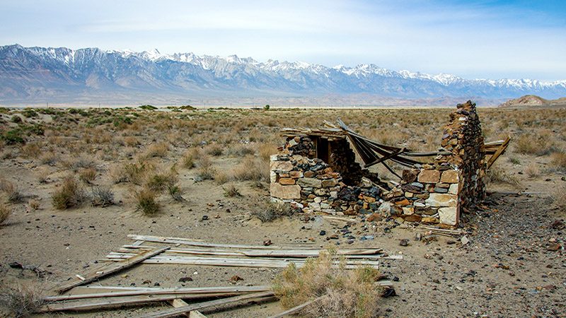
Today, only a few people still live in these towns which are what keeps them from becoming true “ghost towns”. Wind and time have left little evidence of those more prosperous times of the late 1890’s and early 1900’s.
Interagency Visitor Center
Our trip starts one mile south of Lone Pine at the Eastern Sierra Interagency Visitor Center located at the junction of Highways 395 and 136. If you haven’t stopped here before, you should. The center offers a wealth of information along with several well done interpretive displays that cover area subjects such as the L.A. Aqueduct and the topography of the Sierras.
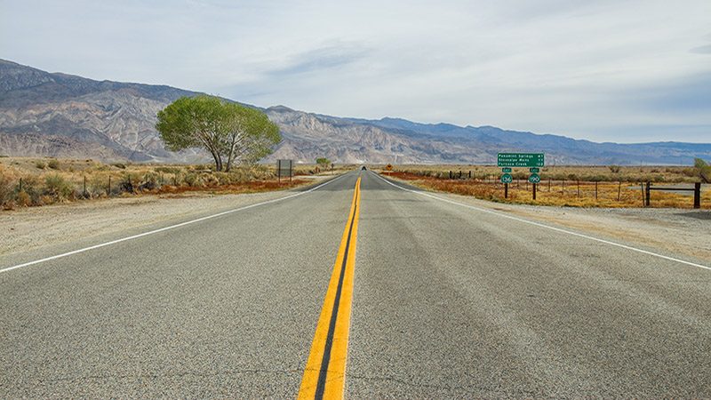
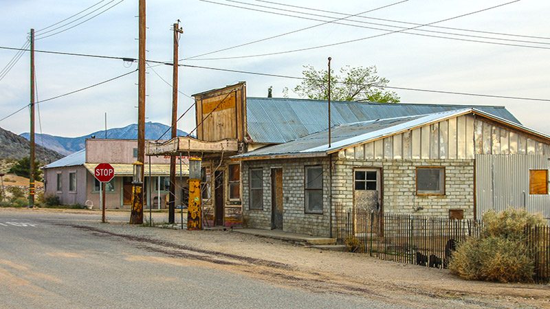
At the visitor center, reset your odometer, then head east on Hwy 136. You are now headed straight towards the mighty Inyo Mountains and the wide open expanse of Owens Lake on the right. Before leaving, make sure you filled up your tank full of gas in Lone Pine. You’ll see some gas stations along our route but they haven’t pumped gasoline for decades!
At 2.6 miles, you’ll cross the Owens River. This once mighty river used to drain the Eastern Sierras and deposit that water into Owens Lake just to the right. If you look back and west at this point, you’ll be rewarded with a grand view of the Sierras themselves.
Dolomite Loop
At 3.4 miles, as Hwy. 136 bears right, turn left onto Dolomite Loop. At about 5.7 miles, look for some very large holes in the mountain to the left. Notice how much of this rock is white. This is the beginning of the huge Inyo Dolomite Quarry. High-quality dolomite limestone marble has been dug out of this site since 1862 and it’s still being quarried today. Marble from this site was used in the construction of many famous California buildings including Los Angeles’ City Hall and its International Airport. The marble was also used to create classic 1920’s-era Terrazzo flooring.
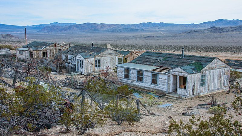
Continue on to a large, gated driveway at 6.7 miles. Behind this locked entrance is our first ghost town. About a quarter of a mile past the gate are the remains of several buildings that were once the company town for the dolomite quarry. In more productive years, company workers lived here and several of those buildings still stand today. None of these old buildings are used anymore having been replaced with the modern industrial buildings behind the ghost town. All of the buildings are on private property.
At 7.9 miles, Dolomite Loop rejoins Hwy 136. Before turning left to get back on the highway however, notice the historical marker on the right that explains Dolomite.
Tramway
At 8.9 miles, you’ll see a small building off the road on the left. This is the site of “Tramway” which was the terminus of the Saline Valley salt aerial tramway. Not really a town, it was a cluster of buildings and a siding along the Carson & Colorado Railroad (more on that later).
This aerial tramway was an engineering masterpiece when it was built in 1912. It transported the salt that was mined in Saline Valley, the next big valley to the northeast, and stretched 13.5 miles over the Inyo Mountains. From Saline Valley, the tramway climbed up 7,500 feet and then descended 5,000 feet down into Owens Valley. Salt was dumped from the tram buckets and then loaded onto train cars. This all occurred between the road and the foot of the mountain. You can still see the first tramway tower on the hill above. The tramway operated on and off until 1933.
Petroglyphs
Our next stop is to see some unusual Native American petroglyphs that may mark the site of a very old ghost town. Look for a faint dirt road on the left at 9.4 miles. Go up this road a short distance and park your vehicle.
Walk over the open desert to the northwest, paralleling the highway back to Lone Pine. Soon, you’ll come to a steep ridge. Follow the ridgeline to the right and you’ll see the petroglyphs.
Most petroglyphs are drawn on dark, almost black, rocks but these are on beige rocks. This is what makes them unusual as well as a little difficult to see. When you’re done looking, return to the highway and continue your trip.
Swansea
In 9.8 miles, you will arrive at the old smelting town of Swansea. This town sprung up in 1869 when a company built several blast furnaces here to process silver from a large mine high up in the Inyo Mountains named Cerro Gordo. A year later, Swansea became a port on the Owens Lake where a steam boat docked to load silver ingots for transport to the town of Cartago on the south end of the lake.
A single building on the left, now a residence, marks the site of the town site of Swansea. Once there were many wooden buildings behind the residence but over the years they have disappeared. Park on the right side of the road to see the historical marker and the remains of the smelter. The smelter itself, which is a small pile of eroded red bricks located just beyond the marker, is unfortunately disappearing into the desert sand. It was much bigger just two decades ago.
Keeler
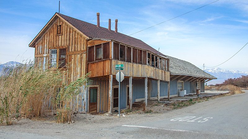
At 12.8 miles, turn right onto Malone Street and into the heart of Keeler. This rather interesting town sprung up to support the large increase in activity at the Cerro Gordo silver mines mentioned earlier. The 1872 Lone Pine earthquake disabled the port at Swansea so a new one was built in what was then called Hawley.
Renamed Keeler in 1880, it started out as a supply town and transportation hub for Cerro Gordo and other area mines. Silver from Cerro Gordo would later supply the funding for the growth of a small village named Los Angeles. Cerro Gordo was the mine that changed the “tide of money” which, back then, usually flowed to San Francisco but was now flowing to Los Angeles since it was much closer.
The narrow gauge Carson and Colorado Railway reached Keeler in 1883. The 300 mile line started near Virginia City, Nevada, and ended in Keeler. Decreasing the costs of shipping ore, the railroad brought even more commerce to Keeler as other mines needed to ship various salts, borax, talc and dolomite. In 1900, the line was sold to the Southern Pacific and continued to thrive due to increased mining activity further to the north in Tonopah and Goldfield. The line continued to serve Keeler until 1960. One of the gems of Keeler is its surviving train depot.
Believe it or not, Keeler experiences the worst air pollution in California. After Owens Lake dried up in the 1940s, the wind began blowing large plumes of alkaline dust through Keeler making it impossible to breath. Recently, a multi-billion dollar lawsuit was won and the City of Los Angeles is now flooding the lake bed once again to remedy the dust problem.
According to the 2010 census, 66 people call Keeler home. This is evident when you take a swing through town. You’ll find a collection of old and eclectic buildings as well as collections of various old artifacts from a once booming mining town.
More…
Pictures
Below are some pictures of what you will see along the way.
Cerro Gordo
Get back to Hwy 136 and turn right. Go a short distance and turn left onto Cerro Gordo St. Then pull over and stop. Located here is another historical marker about the ghost town of Cerro Gordo. High above you in the mountains, but not in sight, is the town and mines of Cerro Gordo.
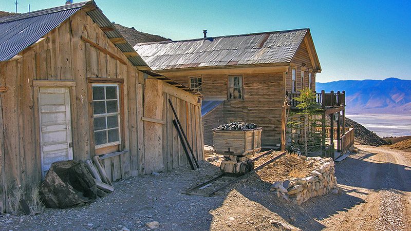
Continuing on this dirt road will take you to Cerro Gordo but should only be done in a 4WD vehicle. The road is not part of our suggested trip. It is very steep and not for someone that is afraid of heights. You can easily spend half day on this road alone. The ghost town is privately owned and sometimes welcomes visitors to its tiny museum. Along the way, look for the remains of an aerial tramway that used to stretch between Keeler and Cerro Gordo. In one spot, there’s still an ore bucket dangling high on a cable above a canyon.
Several mines were discovered and started by Mexican prospectors at the end of the Civil War and all of them had names reflecting their heritage. Cerro Gordo translates to “Fat Pig”. By 1868, investors from afar heard of the quality silver ore and the rush was on. Two years later, furnaces were producing nine tons of pure silver per day! The ingots couldn’t be shipped out fast enough. Miners seeking shelter literally built homes out of silver ingots, just like Eskimos build igloos out of ice blocks.
Silver mining continued until about 1879 when pay dirt was played out and other booms were beginning, such as the one close by in Darwin (our last stop on this trip). New veins were discovered in 1907 and Cerro Gordo saw a revival. Mining continued until the mid-1930s. After World War II, various mining efforts in the surrounding mountains showed a lot of promise but not much materialized. If you’re taking this side trip, retrace your route back to Hwy. 136.
To continue the trip, reset your odometer at this junction and turn left onto Hwy 136.
Talc City
Our next stop, which will be the Talc City turnoff, is 14.6 miles from Cerro Gordo Road. At 4.6 miles, SR 190 joins in from the right. At this intersection, there is an interesting kiosk that explains some of the history of the area. Continue straight (southeast) on SR 190.
As the name implies, Talc City is the location of a series of talc mines. Although not a ghost town, several buildings were scattered in this small area that served as offices and houses for the miners, so it was close to being a “town”.
Talc was first mined in Inyo County just after World War I. There are a series of many talc mines that lie in a 125 mile-long straight line, starting near Shoshone, through Death and Panamint Valleys, Talc City, Saline Valley and Owens Valley. This “line” was a major producer of talc from the 1920s until roughly 1980. Talc from the Death Valley area was shipped south to Victorville where it was milled. Talc from this area was shipped, often by rail from Keeler, to all over California.
Talc, sometimes known as soapstone, has many uses. Its mineral name is magnesium silicate. Everyone has probably heard of talcum powder. It is used to absorb moisture, oils and odors. Talc is also used in the production of paint, ceramics, paper, cosmetics, tires, building materials and many other things.
During World War II, high-tech war tools such as radios and radar were being developed and talc was needed for certain electronic components. Soon, miners realized that talc was the new gold. In fact, more money was earned from Inyo County talc mines than all other mines combined, including gold.
By the 1970s, the need for talc was beginning to fade. In the electronics industry, other materials, such as silicon, were being used. The nail in the coffin for many talc mines in Inyo County was the introduction of much cheaper talc from China. By 1990, most talc mines were no longer operating.
At 14.6 miles, turn left off SR 190 and make an immediate right. You will now be on Talc City Road. Visiting Talc City requires a high-clearance vehicle. If you don’t have one, keep going on SR 190 and turn right onto Darwin Road at 17.4 miles to continue this trip.
A trip through Talc City will take you past several of the mine sites. Look for the first mine at 16.6 miles on the left. At 17 miles, keep left (straight) at the fork. At 17.4 miles, more diggings are passed on the right. At 17.5 miles, bear right and follow the main road as it makes a sweeping 180 degree turn back to the south. At 17.9 miles, another mine and several ruins are on the left. The flat area is where one of the company towns existed. At 18.2 miles, you will pass by an area where talc ore was loaded into haul trucks. You may see the remains of a few old trucks and skip loaders. Just down the road is another mine on the left. At 18.6 miles, bear left at the fork. Keep going until this road dead-ends at the pavement of SR 190.
Darwin
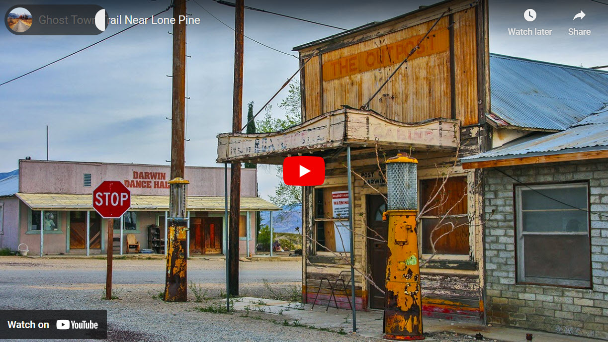
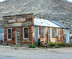
At the end of the dirt from Talc City, cross over SR 190 and head east down paved Darwin Road. Roughly a half mile before reaching Darwin, look for the large Darwin Mines complex and company town (still active in 2016) on the left. Downtown Darwin is reached at 5.7 miles from SR 190. Here you’ll find another town that is “almost” a ghost town. As of the 2010 census, 43 people call Darwin home. Like Keeler, Darwin sports a post office that’s still open. Darwin’s opened in 1875.
Rich silver-lead ore deposits were discovered here in 1874. By 1880, Darwin became a full-fledged mining town, complete with saloons, hotels, dance halls (aka brothels) and smelters to process the ore. Many of the businesses came over from Cerro Gordo, which by now was beginning to fade. With the new Darwin rush came the normal rough and ready people common at mining camps.
Unlike other mining towns in the Southwest though, Darwin held on to life for a long time. By 1884, the easy surface mining was exhausted and the big rush faded. Plus, miners and businesses were being lured to the Bodie mining rush of the 1880’s. Some miners at Darwin, however, kept digging and discovered that Ophir Mountain (to the north of Darwin) was rich with all kinds of minerals, mainly zinc, tungsten, antimony and others. When the two World Wars came along, demand for these minerals increased and so did mining activity at Darwin.
By the late 1950’s, mining slowed down. After decades of mining the combined minerals, Darwin experienced a total production of $35-40 million. When compared to other mining areas, this is considered very good.
We were lucky to partake in a tour of the Darwin Mines complex. This site was the original Defiance Mine back in the 1880’s and was later operated by the Anaconda Mining Corporation in the middle 1900’s. Today it has been owned since the 1990s by husband and wife entrepreneurs that have big plans to bring more minerals out. Mining engineers say that valuable ore is reachable from the mine’s massive, existing tunnel network. Since California’s laws are so strict now, building any type of mill for processing the ore would be unthinkable. However, because of the mine’s tunnels and caverns, much of the processing can be done underground, bypassing environmental regulations. Hopefully, they can make a go of it and breathe new life into this forgotten corner of the desert.
Wandering the streets of Darwin (there aren’t very many) is definitely a different experience than wandering around other old towns. Many of the old buildings are second generation, meaning they were not the original ones built in the 1880’s. Many of the town’s occupants have collected various antique odds and ends which are fun to look at. Remember that this is all private party, so enjoy looking at the artifacts from the street.
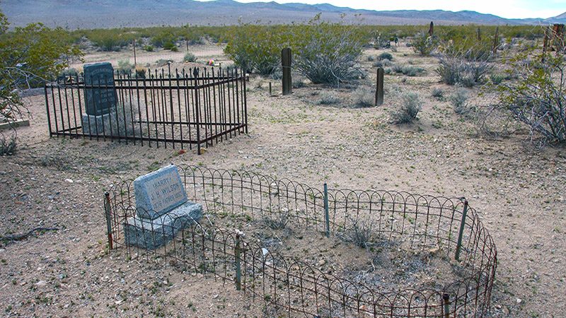
The cemetery is the typical old style with big headstones and wood fences around some of the plots. Visiting it is worthwhile if you haven’t seen an old western cemetery before. It is located by turning right on Main Street (at the stop sign) head southwest for a quarter of a mile, then turn right and continue for another quarter mile.
That’s it for our tour. From Darwin, either take the paved road back to SR 190 or, if you like 4WD adventure, go north on Main Street to explore China Garden Spring, Darwin Falls and the amazing canyon that they are both in. All are located inside Death Valley National Park.
See more places to visit around Lone Pine.
Trip Map
To help plan your trip, either use our interactive Google Map below or download our GPX file that points out the places to see that are mentioned in this chapter.
Click here to download our GPX file for the Ghost Town Trail. We recommend using a GPS mapping app, such as Gaia GPS, to view these points on your computer or to locate them using GPS with your mobile device or phone. Click the ad below to purchase Gaia GPS using our discount code which offers up to a 50% discount.
Learn more about our maps.
Support Us
Help us fill up our tank with gas for our next trip by donating $5 and we’ll bring you back more quality virtual tours of our trips!
Your credit card payment is safe and easy using PayPal. Click the [Donate] button to get started:
