Eagle Crags Hike Near Zion
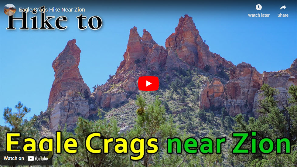
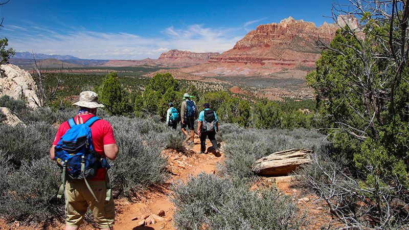
Just south of Zion National Park is a seldom visited hiking trail that offers great views of the surrounding landscape as well as a look into Zion Canyon itself. The hike up to Eagle Crags offers some of the best epic views of the impressive and colorful landscape in this area. Hiking this trial is a great way to escape the crowds of Zion while still enjoying some stunning scenery.
Trip Specs
Length
Attractions
- Walk below large sandstone spires
- Views into Zion Canyon
- Views into Parunuweap
- Abundant desert flora
- Amazing geology
Difficulty
- Trail is rocky in spots
- Remote area
- Flashflood danger
- Rock slide danger
- There is usually phone reception
Elevation Gain
- 600 foot total gain
- 150 foot total loss
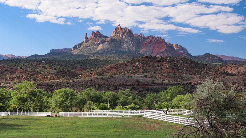
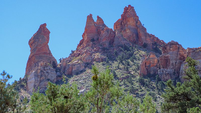
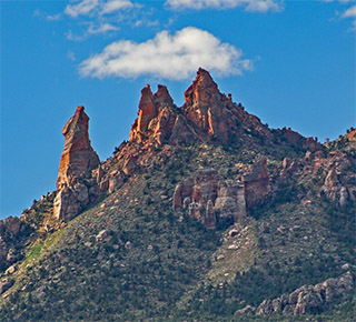
Eagle Crags is a group of rocky pinnacles that are made of Navajo Sandstone and are unlike the many other geologic features found around Zion. It is a very prominent feature that catches the eye of anyone traveling Highway 9.
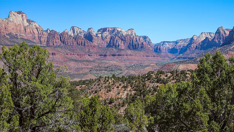
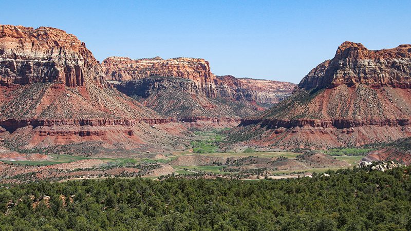
Located to the south of Zion Canyon’s gateway town of Springdale, the trail to Eagle Crags climbs the large ridge on the south side of Highway 9 and goes southeast into the Canaan Mountain Wilderness. All along the trial, you’ll have awesome views of Zion Canyon to the north with all of its surrounding peaks, such as The Sentinel and West Temple. After a mile and a half of hiking, you’ll also have views into Zion Canyon’s “little brother”, Parunuweap, to the east.
Getting There
The easiest way to find the trailhead is to use Google Maps, search for Eagle Crags Trailhead, then follow the navigation. To get to the trailhead without doing that, start by getting yourself to the town of Rockville on Highway 9. On the east side of town, look for the highway’s intersection with Bridge Road and turn south.
Immediately, you’ll be in a Rockville neighborhood so drive slowly and enjoy the small town feel. Soon you’ll cross over the Virgin River via the historic Rockville Bridge that was built in the 1920s. It was originally built to link Zion National Park with the Grand Canyon’s north rim at a time when both parks were being promoted to the new motor-touring public. In 1930, the famous Zion-Mt. Carmel Tunnel was completed and the bridge was no longer the preferred way to travel. The Rockville Bridge you see today was completely renovated in 2017 and has kept its historic look.
Shortly after crossing the bridge, bear left, or straight, onto the road that climbs the mountainside ahead. The main road, which makes a 90-degree right turn, heads to the ghost town of Grafton and Gooseberry Mesa. Visiting Grafton, which is 3.2 miles (about ten minutes) from this intersection, is a fun little side trip. The road to Gooseberry Mesa, known as Smithsonian Butte Scenic Byway, is a rugged dirt road that climbs steeply out of the valley and onto the mesas above, eventually connecting with Highway 59 to the south.
Before continuing straight at this junction to Eagle Crags, make sure you have a capable vehicle and that there has been no significant rain or show recently. If the road is muddy, not only will it be difficult to drive on but your vehicle will be a muddy mess. Even a 4WD vehicle will have a tough time. If the road isn’t muddy, make sure you are driving a vehicle, such as a truck or SUV, that has plenty of ground clearance. It doesn’t necessarily need to have 4WD but, if you don’t have high enough ground clearance, your undercarriage will get banged up on this road about a mile in.
From the junction, continue following the main road for 1.5 miles. It starts with a steep climb up what’s called the Moenkopi Formation, a multi-striped collection of strata that has a very corrugated look. At the top, various residential roads and driveways will veer left and right, so make sure to stay on the main road. The trailhead is on the right and easy to find.
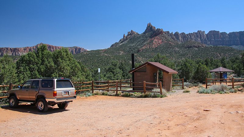
There is parking at the trailhead for about 6 to 8 vehicles. There is also one of Utah’s famously-clean pit toilets and an informative kiosk with a map of the area.
More…
Support Us
Help us fill up our tank with gas for our next trip by donating $5 and we’ll bring you back more quality virtual tours of our trips!
Your credit card payment is safe and easy using PayPal. Click the [Donate] button to get started:
Pictures
Below are some pictures of what you will see along the way.
The Hike
From the trailhead, the trail heads to the southeast in the direction of Eagle Crags, which are visible in the distance. The trail is easy to follow and well-maintained for the next 2.5 miles. It begins gradually descending into a ravine, then begins to climb. Overall, the trail is fairly level with an elevation gain of 500 feet over 1.5 miles.
Although we’ll only be hiking 2 miles of it, this entire trail actually goes quite a distance. After passing Eagle Crags, it climbs steeply onto Canaan Mountain. The top of this mountain is known for its swirling and colorful sandstone, similar to Highway 9’s east entrance through Zion National Park. The trail ends at another popular hike, the Water Canyon Trailhead, in the town of Hildale, roughly 8.5 “crow fly” miles away. For some people, hiking from Eagle Crags to Water Canyon makes for a great multi-night backpacking adventure.
The Views
Because the trail is in a transition zone between desert and mountain plateau, it takes you through a wide variety of flora, including all kinds of cacti, yuccas, junipers, and pine trees. In April and May, expect to see the brilliant red flowers of the appropriately named claret cup cactus, also known as the Mojave mound cactus. You may also see plenty of blooming yuccas, both banana and Utah yuccas, with their singular flower spikes and cream-colored flowers.
Be sure to stop often and look around as you hike this trail. There are views in all directions that change frequently and there’s lots of fabulous scenery. About 1.7 miles from the trailhead, look for a promontory that juts out to the north (left side of the trail). Although there is no trail, walk out onto this level peninsula that provides a commanding view in all directions.
To the south, you can look straight up Zion Canyon. This is a view you can only get from here or in an airplane! If you watch our virtual video tour of this hike (see details below), it will point out all the well-known peaks and landmarks in Zion Canyon, such as West Temple, Angels Landing and Observation Point.
To the east, you’ll get a view into Parunuweap, which is the canyon that was carved out by the East Fork of the Virgin River. Parunuweap, also known as “The Barracks”, is a smaller version of Zion Canyon, complete with its own narrows similar to the Zion Narrows. However, because of its remoteness, it is seldomly visited. The “weap” in Parunuweap means “canyon” in the Native American Piute language. In fact, Zion National Park’s original name was Mukuntuweap. If you look at various place names around here, you’ll notice that the “weap” suffix is used a lot.
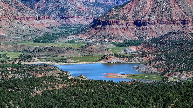
Another reason why Parunuweap is seldomly visited is because the mouth of the canyon, the portion you see from the Eagle Crags hiking trail, is all private property. This property was previously owned by the late Paul Allen, who founded software giant Microsoft with Bill Gates. As of 2023, the property is for sale or has already been sold. Nobody has been able to access this canyon for years. We’ll see if the new landowners allow access or at least private tours into this area.
Hiking another half mile past the promontory will give you a view down onto Trees Ranch Reservoir. This body of water is part of the private property described earlier. The reservoir adds another dimension of beauty to the already magnificent scenery.
Also, around this point, the trial passes below the largest of the crags, Tooele Tower. Formally, this spire was known as Mrs. Butterworth. When you look up at this crag from different angles, see for yourself if it resembles a bottle of pancake syrup.
The nice thing about the Eagle Crags trail is that you can go as far as you want, then turn around and head back to the trailhead following the same route you took in. After about 2.5 miles from the trailhead, the trail becomes increasingly difficult to follow and eventually becomes more difficult to hike due to the terrain.
Trip Map
To help plan your trip, use our interactive Google Map below that points out places mentioned in the article above. Navigating this hike is much easier and safer using a navigation/mapping app on your phone. We highly recommend Gaia GPS as it shows this trail and the surrounding terrain in detail. Click the ad below to purchase Gaia GPS using our discount code which offers up to a significant discount.
Learn more about our maps.
Comments
Read and leave comments about this post on YouTube.
Support Us
Help us fill up our tank with gas for our next trip by donating $5 and we’ll bring you back more quality virtual tours of our trips!
Your credit card payment is safe and easy using PayPal. Click the [Donate] button to get started:
