Cathedral Valley Road Trip
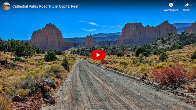
Our road trip this time takes you into the Cathedral Valley area of Capitol Reef National Park in Utah. The Park itself can be divided into three sections: the southern section that is accessed using the Burr Trail and Notom-Bullfrog Road; the middle section where you’ll find the popular points of interest including Capitol Gorge, the Mormon outpost of Fruita and the Visitor Center; and the northern section known as Cathedral Valley. This northern section is where our journey occurs.
About the Cathedral Valley Loop Trip
Cathedral Valley is quite remote and this all-day loop trip requires a high-clearance vehicle. These factors combine to make it a much less crowded experience than the other, more popular spots in the Park and it’s just the kind of back road we love.
Capitol Reef National Park is a region known for its colorful and rugged scenery that was produced by some spectacular geologic events. The most significant of these was the creation of a large ripple in the Earth’s surface known as Waterpocket Fold. Similar to the effects of a large earthquake fault like the San Andreas, Waterpocket Fold is the result of massive uplift and upheaval of the same iconic geologic formations that are so evident in the Grand Canyon and Zion National Parks.
This loop trip through Cathedral Valley follows a long dirt road of about 70 miles (including side trips). It starts and ends on Highway 24 which is the main paved road through Capitol Reef. If you embark on this adventure, there are four things we recommend:
- Take a high-clearance vehicle, preferably with 4WD, and the knowledge of how to use it
- Buy the booklet Cathedral Loop Road Guide, available at the Park’s Visitor Center
- Ask the Visitor Center staff about road conditions
- Carry all the supplies you need for an entire day, including fuel, water, food, etc., as well as emergency supplies because there are no services along this road. Remember, this is a very remote area.
This road trip takes an entire day so get an early start. You’ll need at least 8 hours to fully enjoy it and see all the sights. Of course, you can drive it in less time, but it won’t be as satisfying. And you can also take more time, but you’ll need to camp overnight somewhere along the way. There are several primitive campgrounds along the road.
Geology
In the case of these two Parks, the different-colored formations are like the layers of an onion that are laying flat. In Capitol Reef however, the upheaval of Waterpocket Fold twisted and contorted these same layers/formations. As time passed, that age-old geologic force known as erosion wore away the weaker, softer formations until they are almost completely gone and left behind the stronger, twisted formations we see today.
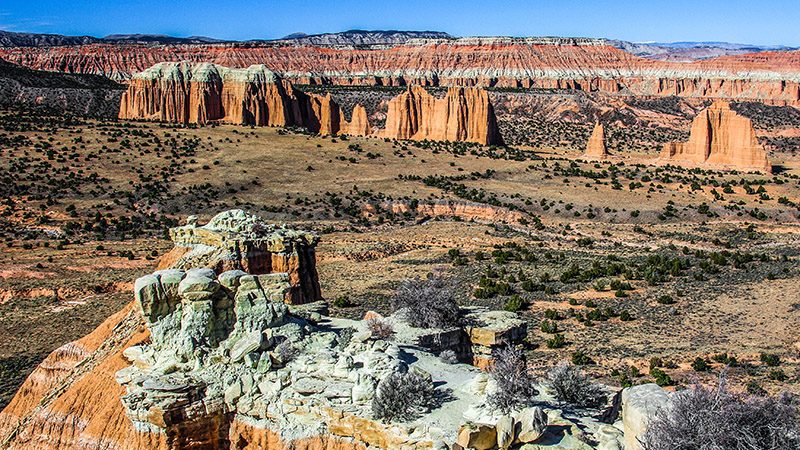
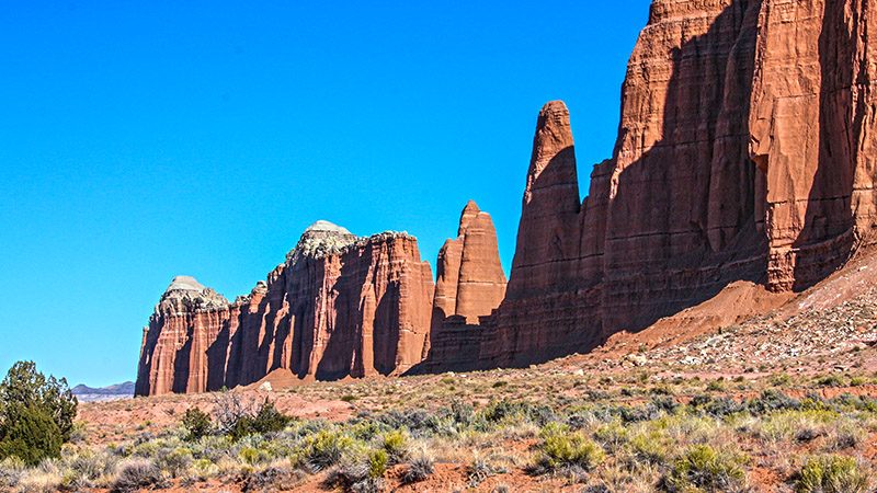
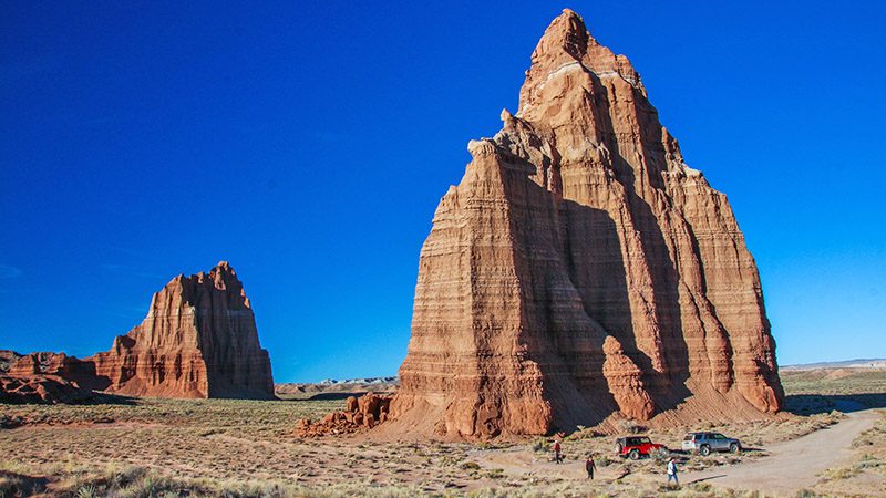
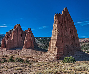
We find that understanding how the geologic formations of Cathedral Valley were created adds to the wonder of it all and helps you to more fully appreciate what you are seeing. There are several rock formations and pinnacles along the way that, as their names imply, stand like grand, gothic, European cathedrals. Those pinnacles are here today simply because their composition (the geologic formation that they are a part of) is more resistant to erosion and decays more slowly. Dirt around these pinnacles, along with material from weaker formations surrounding them, eroded away a long time ago, leaving what you see now. Only in this northern third of Capitol Reef National Park can you see these “cathedrals”.
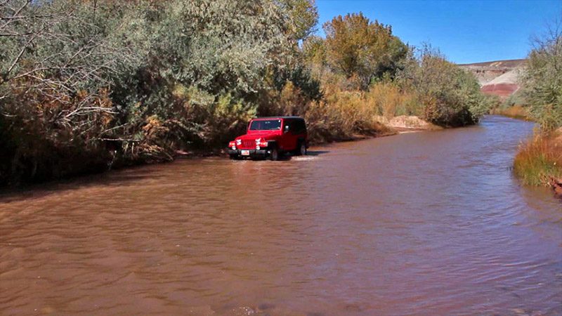
We highly recommend driving the loop in a clockwise direction (as we describe). This starting point is 11.5 miles east of the Visitor Center on Hwy 24. The turnoff is not signed so please see our virtual video tour (link below) to see what the turnoff looks like. Shortly after turning onto the dirt road, you’ll encounter the first and probably biggest challenge; fording the Fremont River. This is the reason to start your trip at this end of the loop. If you take this trip in the opposite direction (counter-clockwise), you’ll end up at this spot and, if the river is too deep to cross, you’ll have to reverse your entire route, all 60 miles of it. Not fun. Of course, you should not attempt to ford the river when the level is high, such as after a big thunderstorm or during the spring runoff. Use your common sense.
More…
Pictures
Below are some pictures of what you will see along the way.
Road Guide – A Must
There’s a lot to see on this trip and that’s why, as mentioned earlier, we recommend picking up the very well-written Cathedral Loop Road Guide available at the Visitor Center. It points out lots of things you would otherwise miss by just driving through the area and answers your questions about what you’re seeing along the way. It also includes a handy foldout map of the entire route.
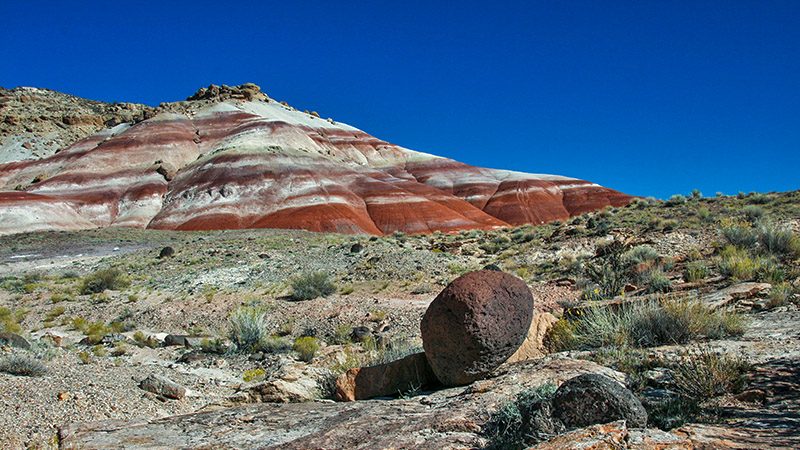
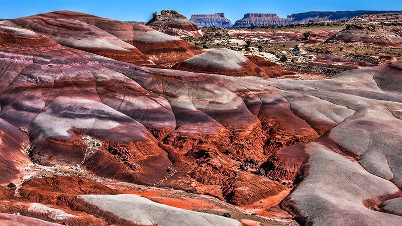
Many of the sights you’ll see include uniquely sculptured sandstone formations (like Utah doesn’t have enough of those already) but these are quite different from those found in the other grand parks of Utah, including Capitol Reef itself. In the first several miles, the road passes by colorful, rounded hills with bands of purple, orange and red. At the 10 mile mark, those banded hills come together in what’s called the Bentonite Hills. They are absolutely stunning!
Then there are the three viewpoints. The first two overlook the “south desert”, which is a colorful valley bordering the Waterpocket Fold. The third overlooks upper Cathedral Valley with its numerous monoliths.
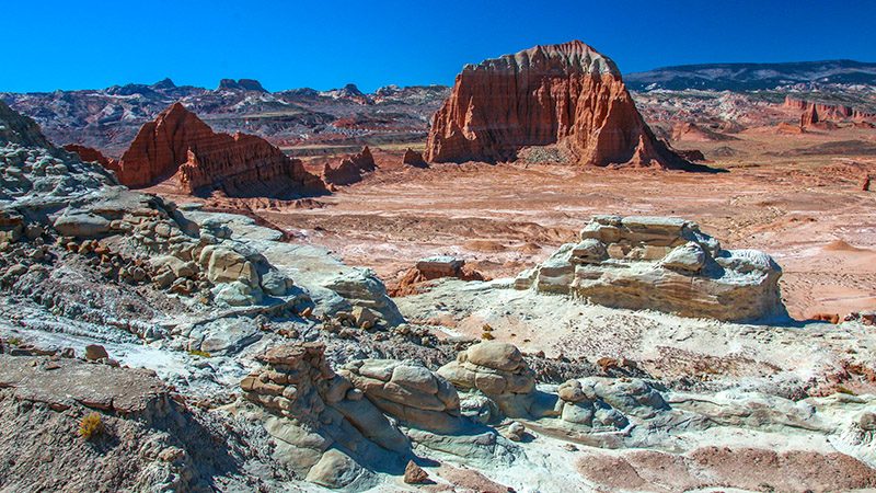
The second half of the loop road passes through Cathedral Valley itself. It passes by places like Gypsum Sinkhole, Temples of the Sun and Moon and a very odd geologic formation called Glass Mountain. In all our geology field trips and tours, we’ve never seen anything like Glass Mountain. It’s a big glob of selenite crystals. Before ending back at Hwy 24, the road passes the dramatic gray and yellow-tinted Caineville Mesas including Factory Butte, which is the one tall, isolated mesa to the far left.
Getting There
Your first stop should be at the park Visitor Center in Fruita along Hwy 24. Check with the rangers inside about the road conditions for the loop trip through Cathedral Valley. Also, ask them the condition of the river ford. If the Visitor Center is closed, weather and road conditions are usually posted near the front door.
From the Visitor Center, head east on Hwy 24. Reset your odometer. The turnoff for the road into Cathedral Valley is found at 11.7 miles. Look for mile-marker 91. If coming from the other direction, the turnoff is 25 miles from the town of Hanksville (junction with Hwy 95).
Follow the road guide from here. The road ends back at Hwy 24, just 6.3 miles to the east of the starting point.
Cathedral Valley is a great example of why unique and untouched landscapes like this needs to be preserved and protected. Thankfully, this area is naturally protected due to its remoteness and is enjoyed only by those that wish to take the time and effort to see this magnificent place.
Trip Map
Support Us
Help us fill up our tank with gas for our next trip by donating $5 and we’ll bring you back more quality virtual tours of our trips!
Your credit card payment is safe and easy using PayPal. Click the [Donate] button to get started:
